
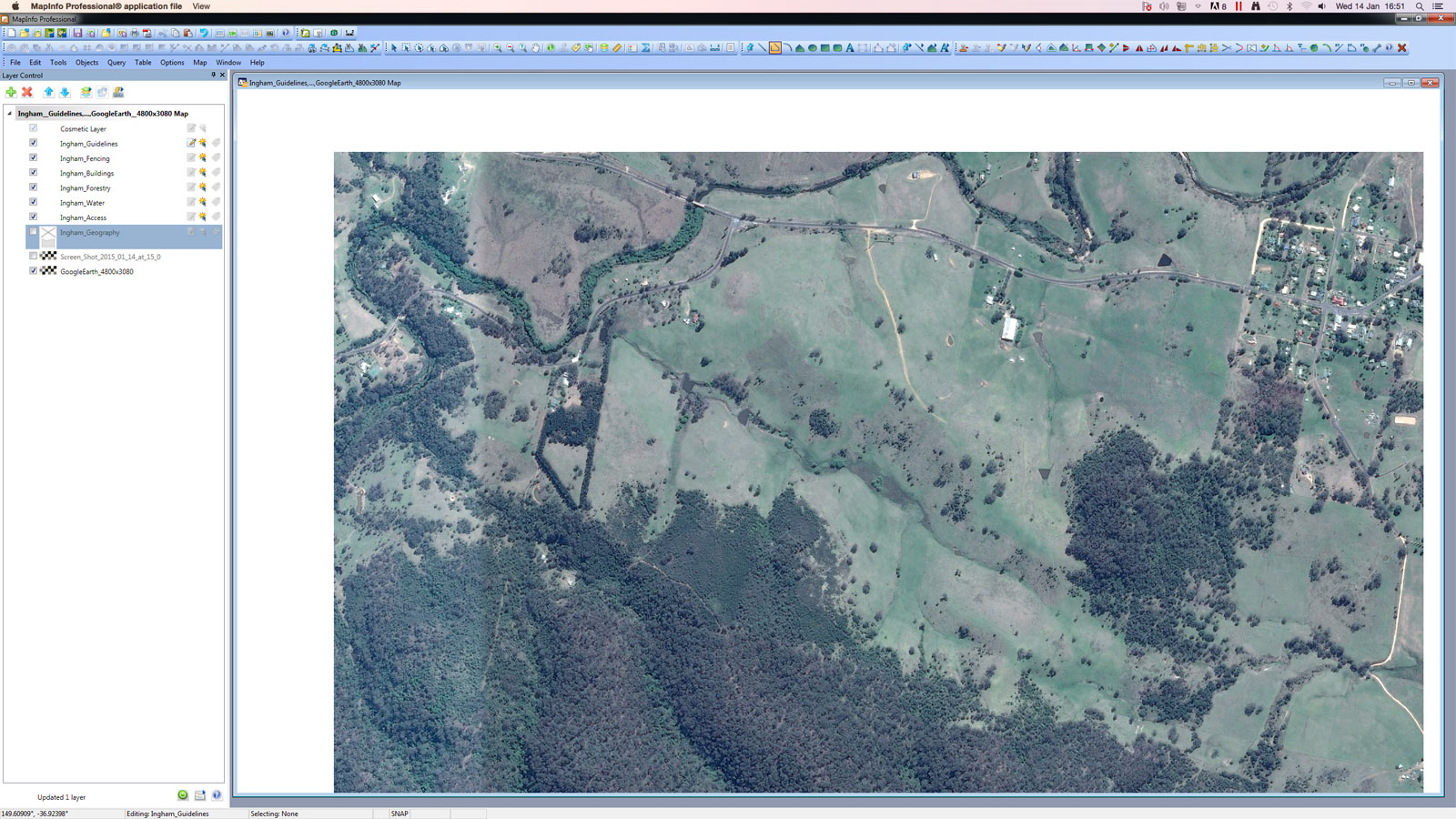
Following the Regrarians Platform watch this remote concept planning process (we haven’t completed a site analysis as yet!) unfold over a day (i.e. 6 hours of Darren Doherty‘s design time + 3 hours of HUMA Design‘s Georgi Pavlov‘s time rendering the finished concept plan draft) starting with 2. Geography.
We took this step in order to provide some concepts & vision to the clients of what could be done with the layout of this property + to provide our networks & alumni another opportunity to see the Regrarians Platform being used.
2. Geography
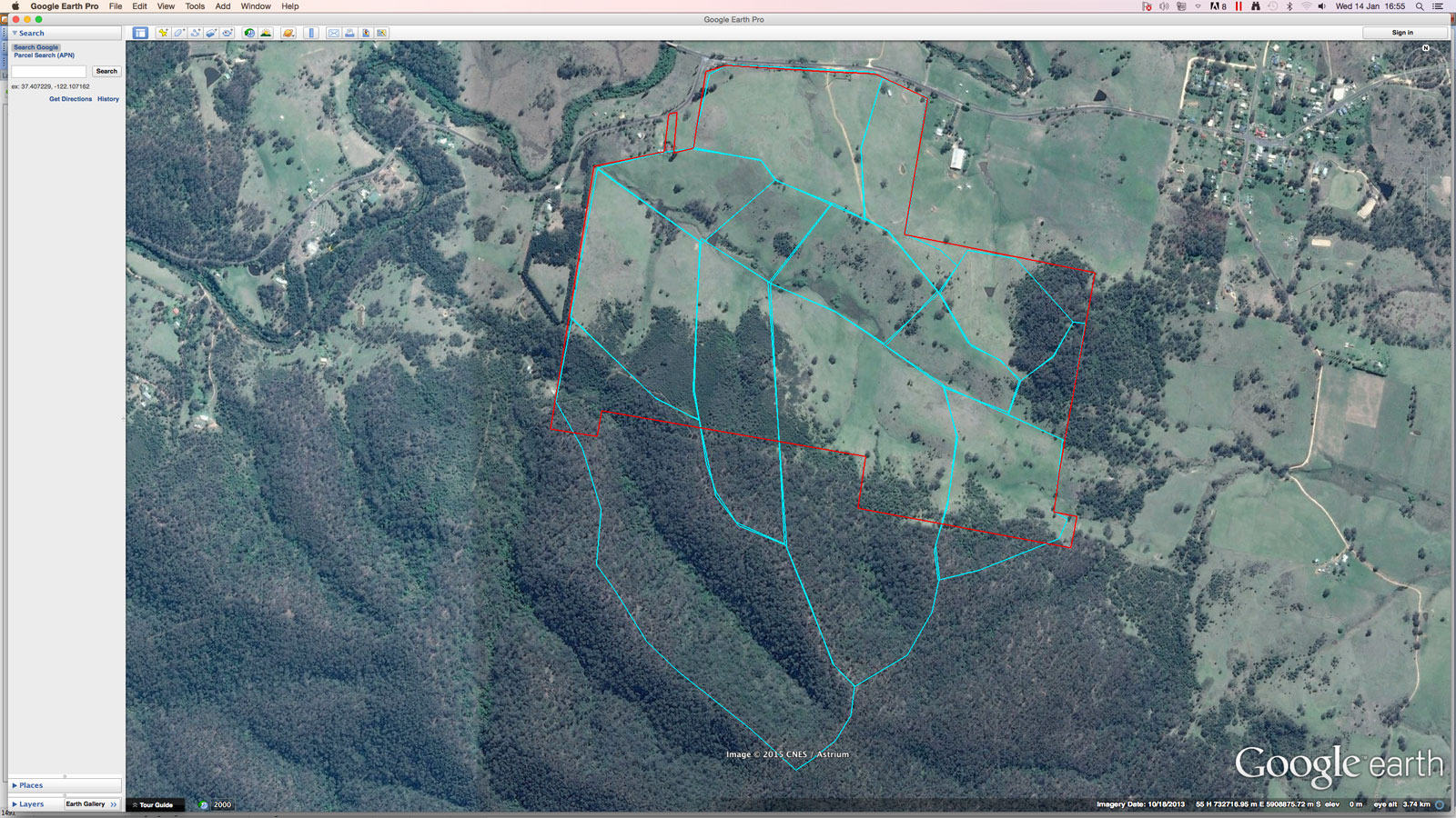
Import and Geographically Register GoogleEarthPro photo
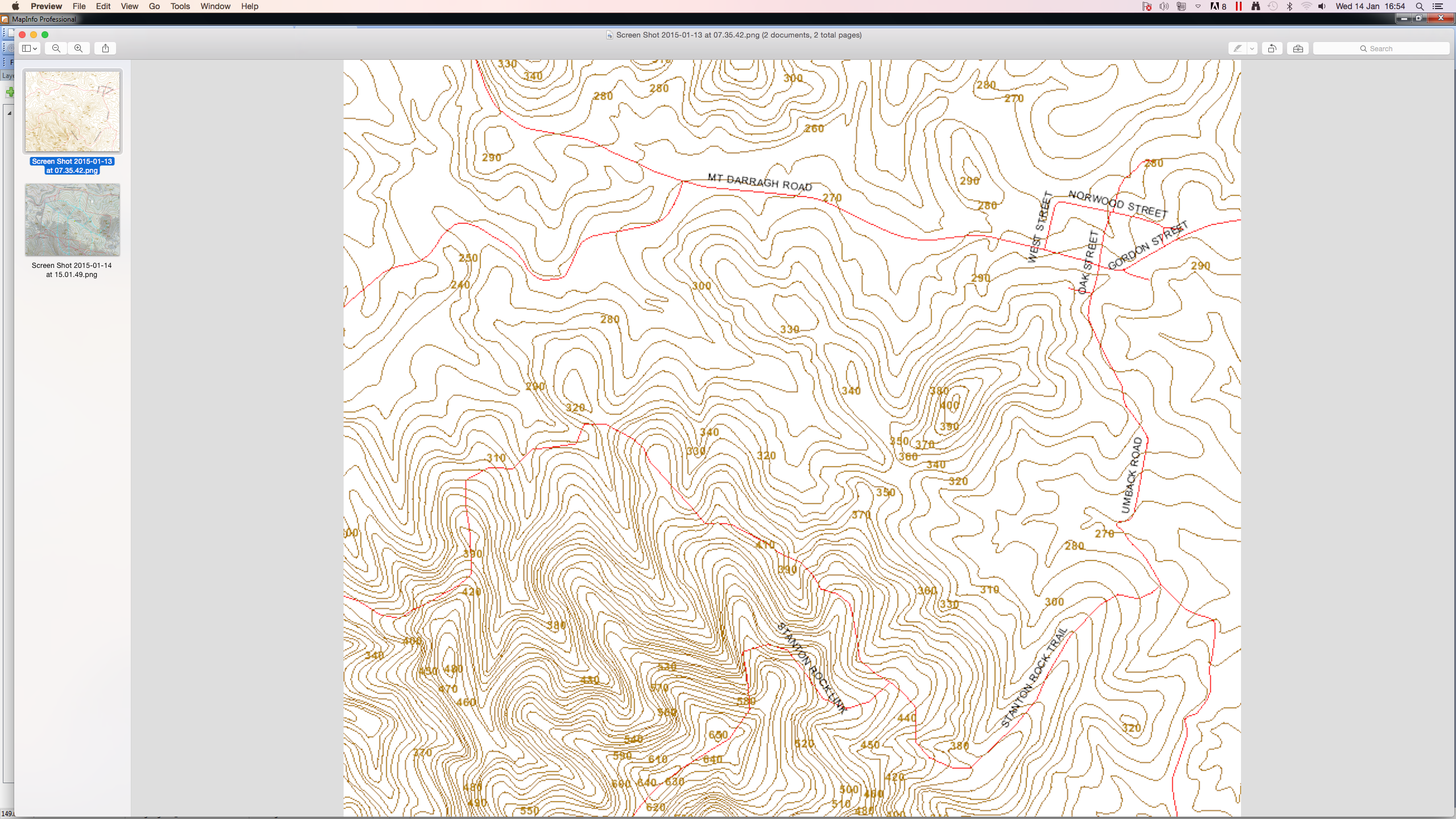
Locate contour map – this one is a 10m interval from VicMap
Digitised Contour Map on GoogleEarthPro photo

Map Catchment Areas in GoogleEarthPro
Remove the contour layer in GoogleEarthPro to leave aerial photo & catchment areas
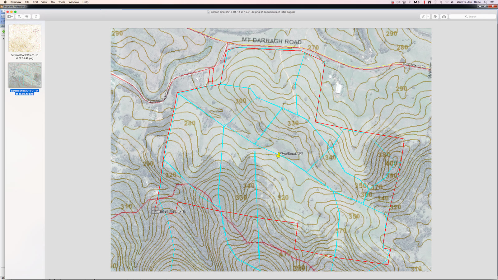
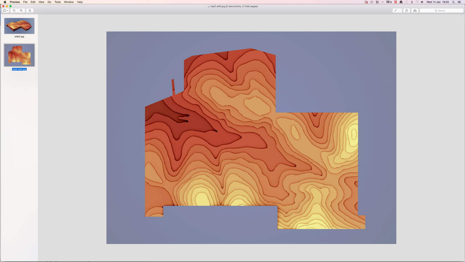
Sent topo plan with boundary marked to HUMA’s Georgi Pavlov and get it back looking like this…
Mark primary land units (Keyline design process)

Mark existing dam locations

Mark Keypoints in primary valleys (approximate due to low resolution contours)

Mark Keylines of respective primary valleys

Mark guidelines on primary ridges
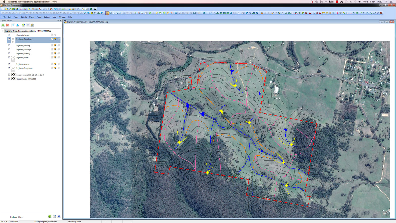
Join Keylines and guidelines

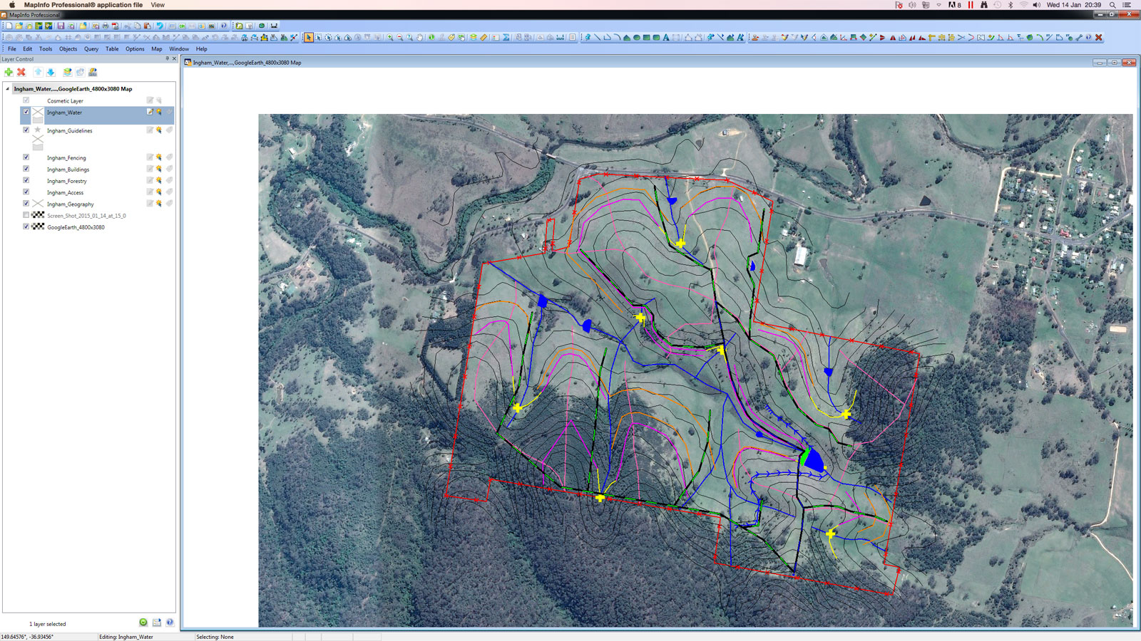
3. Water – Insert Keypoint dam in optimum position – considering elevation and storage efficiency/ratio
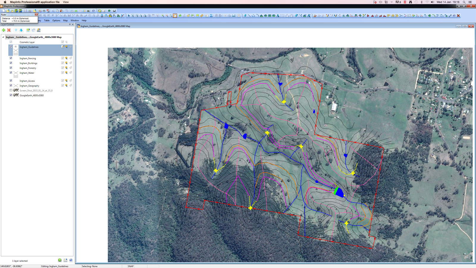
Add diversion drain to harvest water for Keypoint Dam + add overflow drain with level sill spillway (total of 45m long)
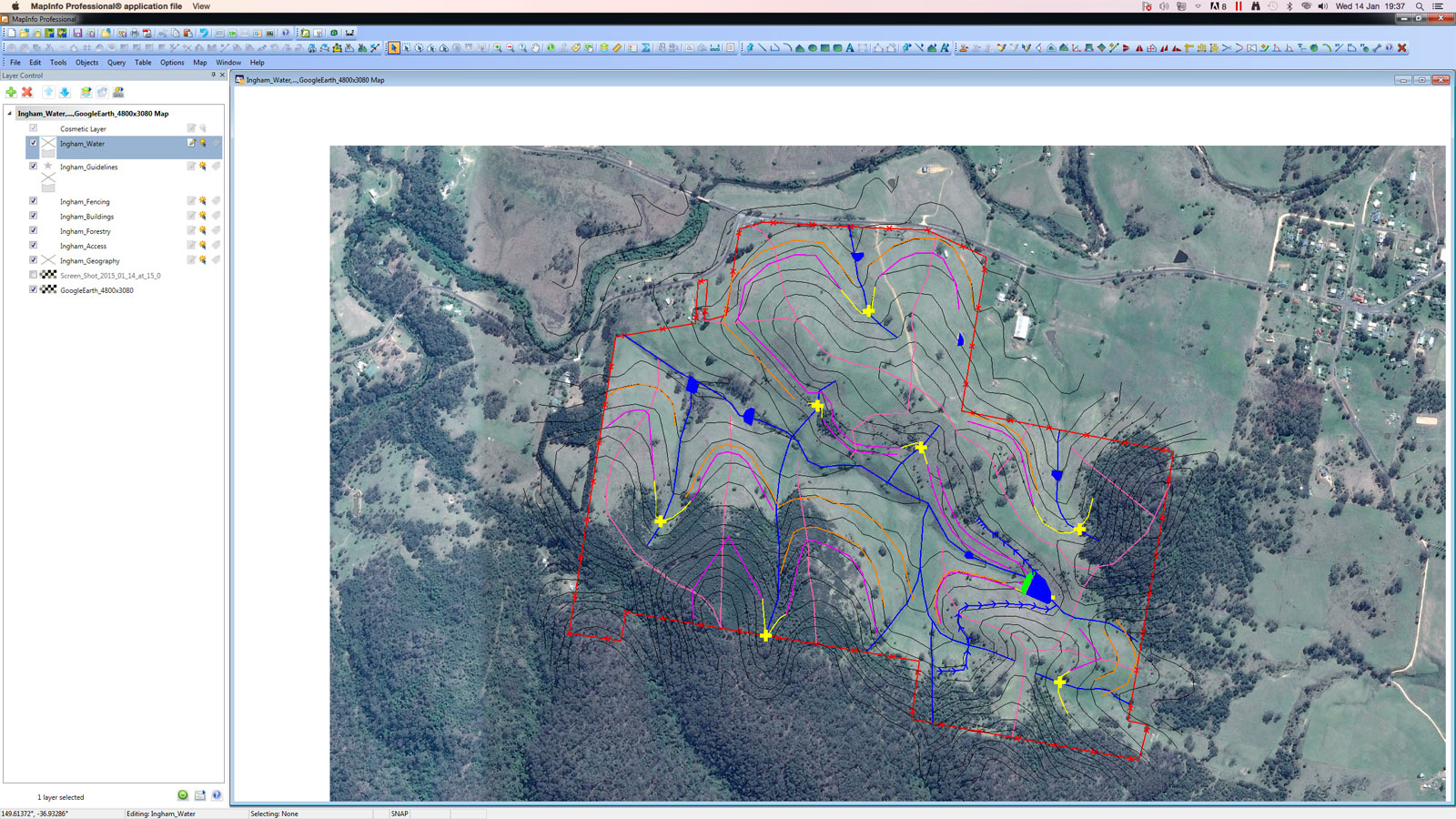
Place pipe network such that their is a maximum of 300m width between pipes to consider 300m electric cross-fence reel length. Blue/Black dash is HDPE & Green/Black Dash is Rural Grade PE (both 50mm/2″ø)
5. Forestry – I’ll come back to 4. Access soon, most of which will follow the water divide lines marked on ridges (salmon colour) – just wanted to fit in the forestry rows (wide spaced ‘savannah’) before finalising the rest of access. These lines are roughing out the forestry systems that will follow the Keyline guidelines. Riparian forests and shelterbelts are to follow.
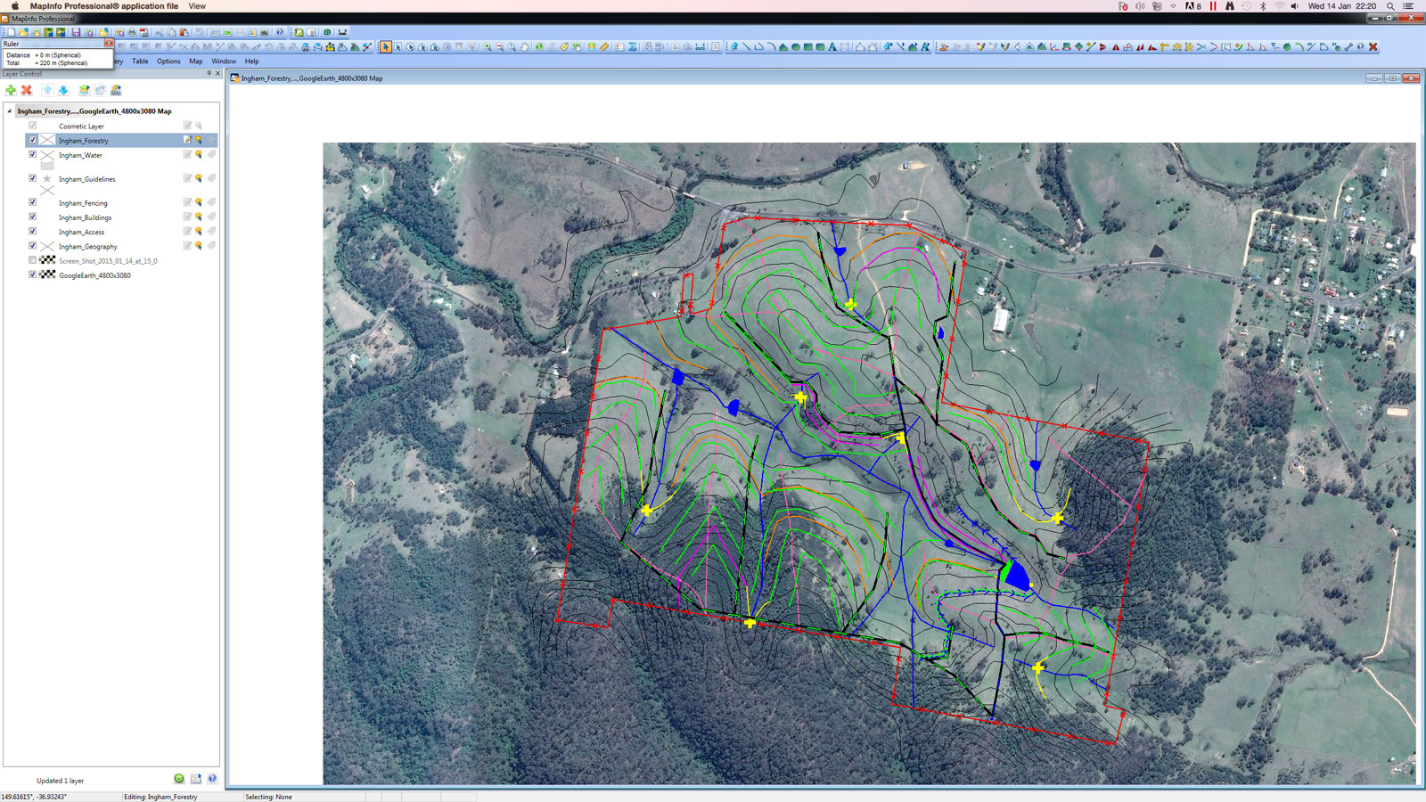
Next step is to change the plain green line-style marked along Keyline Guidelines into a green dotted line-styles to denote wide spaced savannah planting & a tighter spaced layout under the bank of the diversion drain

4. Access – in many cases access roads and tracks are factored directly after completing the water layer. In this case I wanted to see what the 5. Forestry layout would look like first before incorporating the roads. I also added in a couple of ‘Wetland Crossing Ponds’ to provide all weather-access across seasonally wet primary valleys.
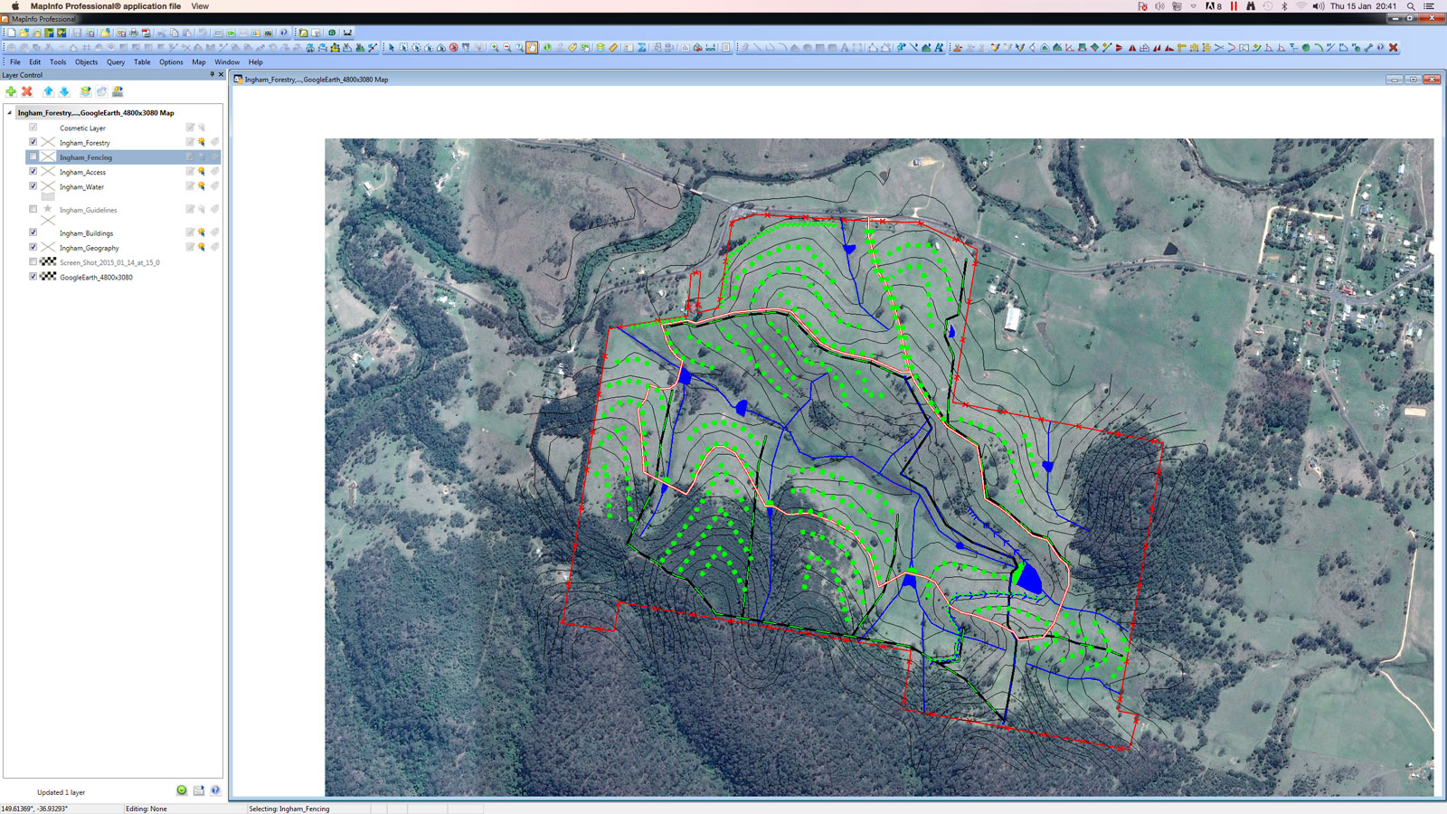
7. Fencing – KiwiTech-based fence layout in which riparian areas, some roads, existing remnant forests & paddocks. Also took the opportunity to clean and trim tree lines, water line positions and roads.

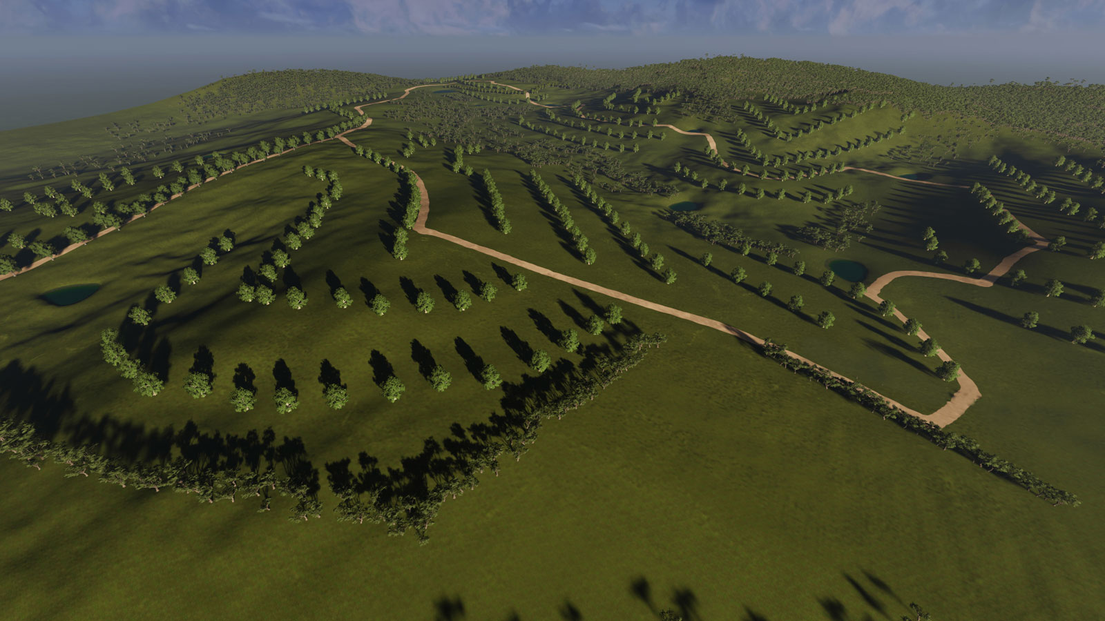
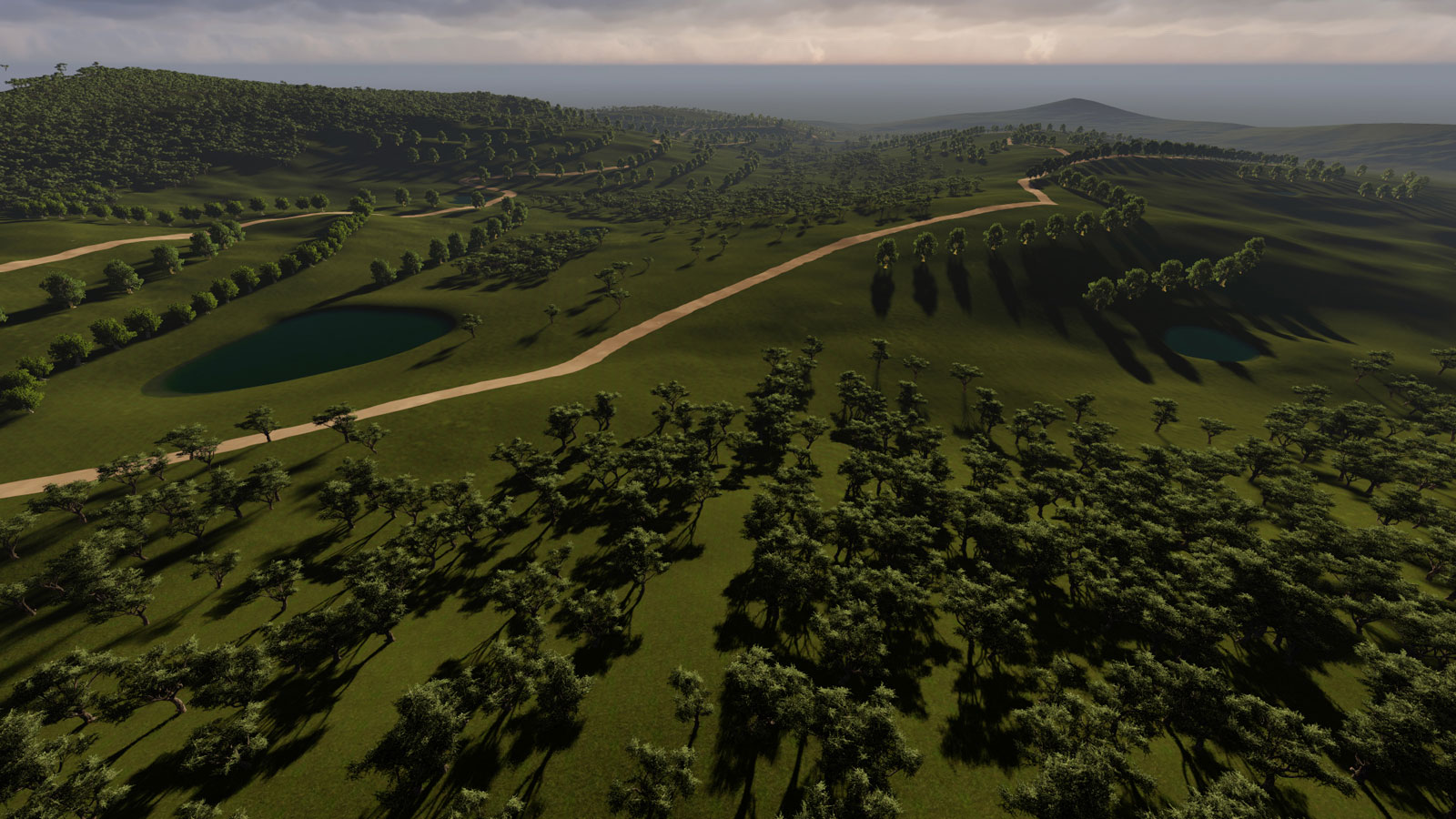
HUMA Designs Concept Plan Render – Huma Design’s Georgi Pavlov has jazzed together this in 3 hours and this brings the design to life beautifully.

Next?? We’ll have a RTK GPS topo/feature survey completed and then do a site analysis. We’ll review this concept plan based on the client, enterprise and landscape contexts and make any necessary revisions and amendments. Accordingly this plan will likely change considerably…
Thanks Darren… really appreciate being able to see what you are up to… feeds my keen interest in developing skills. Much appreciated!
Muchas gracias Darren!!. Siguiendo fielmente tus enseñanzas desde Colombia y poniéndolas en práctica. Un gran abrazo.
Wonderful! Thanks for sharing the process. Very informative!
Pingback: Socjologia
Pingback: Escala de la permanencia ¿como posicionar las cosas agrícolas en su predio? – Secano sin sequia