Regrarians UAV Mapping Service (‘RUAV’)
Advancements in UAV surveying & mapping technology have been rapid over the 6 years that Regrarians have working in this field.
Regrarians own capabilities in this field have increased and we’re pleased to be able to offer members of the Regrarians Workplace access to this service.
RUAV Mapping Service Overview
- You have access to a DJI UAV – e.g. Mavic, Phantom
- You will use the Google Earth Pro, GoogleDrive, DroneDeploy, DJI Go 4 and Regrarians Workplace Chat apps
- You work with Regrarians to generate a flight plan (s) that suits your mapping needs
- You or other parties under your direction fly the UAV over the site you want mapped
- You establish Ground Control Points (‘GCP’) if you purchase the RUAV Precision package
- You upload the images collected to a GoogleDrive folder and share this folder with Regrarians
- We process this imagery for you
- We upload all of the processed maps to your GoogleDrive folder.
- To start the process you pay the RUAV fee and we’ll work with you closely to create a fantastic set of maps.
- If you choose the RFly package we do the planning, GCP’s, flying and processing
RUAV Mapping Packages
• RUAV Basic – USD$40 per flight
• RUAV Standard – USD$80 per flight
• RUAV Precision – USD$170 per flight
• RFly – USD$1500 per day
Map Layers Produced
- Orthomosaic
- Plant Health (RGB – VARI)
- 3D Model
- Contours
- Elevation
- Slope
- Waterflow
- Aspect
- Hillshade
Finished Georeferenced File Formats
.kmz/.kml :
- Orthomosaic
- Plant Health
- Contours
- Elevation
- Slope
- Waterflow
- Aspect
- Hillshade
.obj :
- 3D Model (DSM)
If you want to add Ground Control Points (GCP) to increase the accuracy of your map then you’ll need to buy the RUAV Precision package (USD$170 per flight*).
*120m (400′) is the highest altitude a UAV can fly in many jurisdictions. Always ensure that your use of a UAV is compliant.
*A RUAV Flight consists of 3000 images or less per map
What do I need to do now?
Buy this package and we’ll send you the link to the instructional video we’ve produced to take you through every step involved.
We look forward to working with you to create quality maps that will help you plan, manage and monitor your project that much better.
Regrarians Handbook Sections?
See the RUAV difference!
Following are some comparison topographic maps of the same sites using three (3) different sets of map data:

220ha (clockwise) – Composite of 3 sets of contours > VicPlan (government) 10m contours > FarmingIT RTK UAV 1m contours > RUAV UAV 1m contours (150m alt – 30% overlap). We’ll be updating this map with two other RUAV flights – one at 75m altitude (and 65/70% overlap) and another at the same altitude with GCP’s captured with Regrarians’ Emlid Reach RS RTK GPS unit.

9ha (clockwise) – Composite of 3 sets of contours >VicPlan (government) 10m contours > Local Surveyor Total Station 1m contours > RUAV UAV 1m contours (50m alt – 65/70% overlap). We’ll be updating this map with one other RUAV flights – this time using GCP’s captured with Regrarians’ Emlid Reach RS RTK GPS unit.
Photogrammetry is not new!
Since the World War 2 most of the topographic maps that people use have had the contours derived from a process known as photogrammetry.
Preparing topographic maps using large format aerial photos remains a highly skilled task though in the digital age it is processors not humans who create the contour lines.
This process has become even more accurate than before and is what the RUAV process uses to create its contour data.
When Ground Control Points (GCP’s) are applied to the process the resulting contour lines are very accurate.
Its great that we’ve come to a point in time where anyone with access to a good quality consumable UAV can create low-cost, fast, high resolutions of the type that the RUAV service provides.
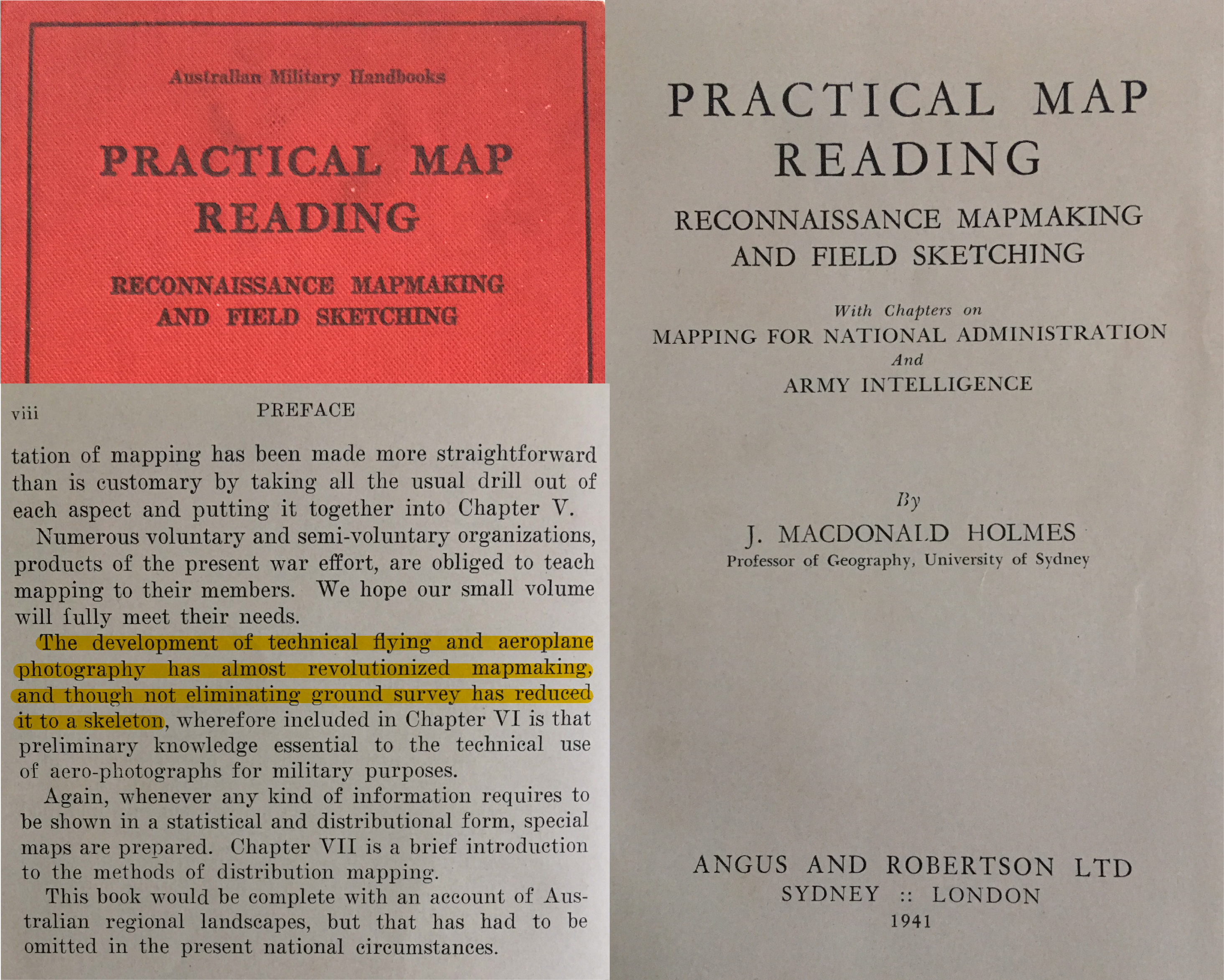
Professor J. Macdonald Holmes, ‘Practical Map Reading’, 1941

9ha – Flight Plan – 50m altitude – 65% sidelap – 70% frontlap – 15m/s flight speed – 18 mins flight time – 1 battery (DJI Mavic Pro)

9ha – Mosaic photo of all of the 470 individual overlapping images captured by Regrarians’ DJI Mavic Pro from an altitude of 50m
Up to Date, High Resolution Aerial Photos
Google Earth Pro and other online mapping services mostly use satellite images.
They are great services and have revolutionised the way people access and interact with maps.
How often though have you looked at a place and found that the image is old and not as clear as you would like, or there’s cloud cover and so on?
The RUAV service changes all of that with anyone able to access good quality consumable UAV now being able to create fantastic aerial photos captured at low altitude (below the clouds!) on they days that work for you and what you want the aerial for.
Here’s some examples of the difference in resolution available between RUAV processed maps and the latest imagery available from Google Earth Pro:

9ha – Top – GoogleEarth Pro – 21st December, 2017 > Bottom – RUAV – 4th September, 2018
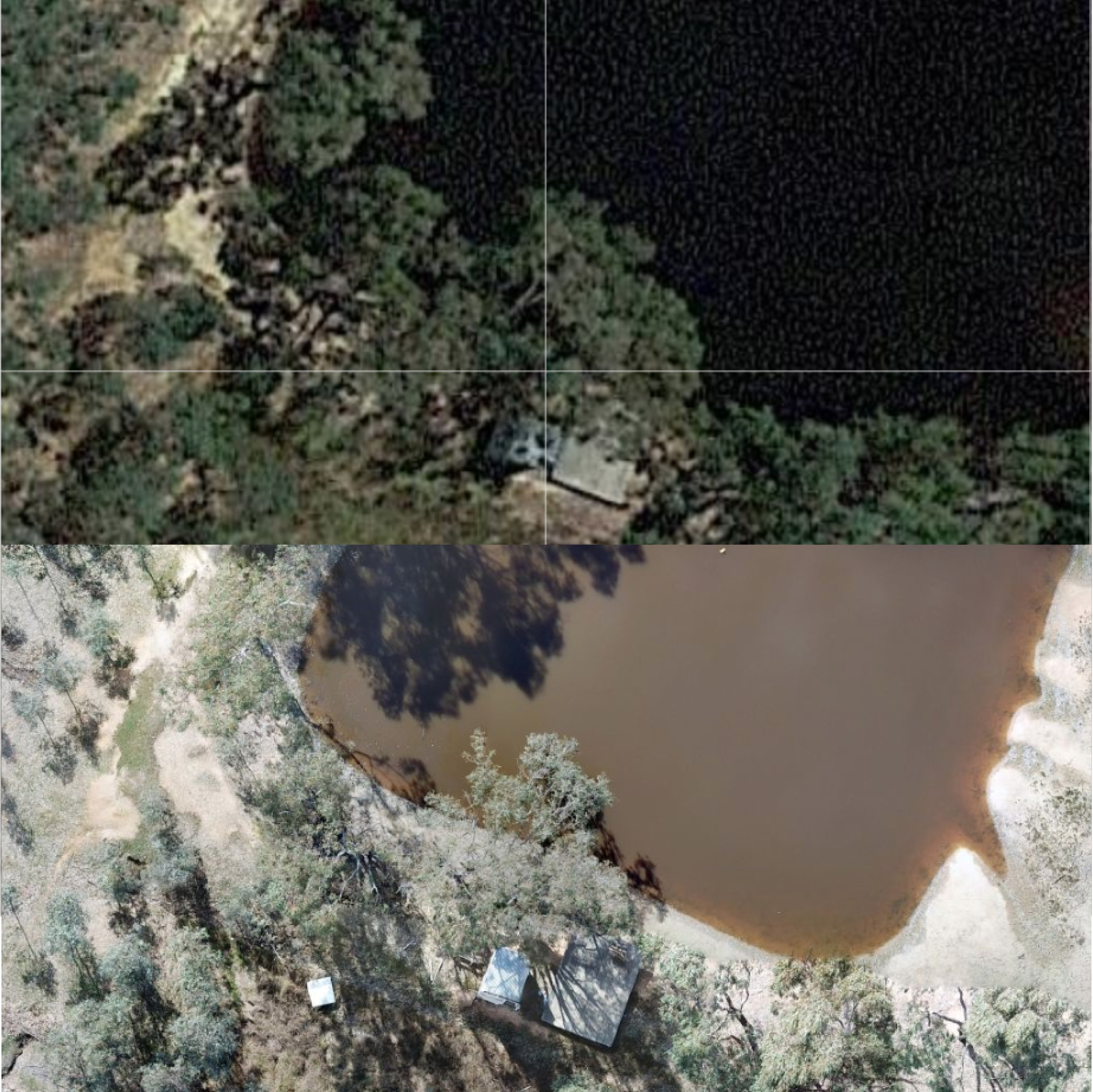
9ha – Top – GoogleEarth Pro – 21st December, 2017 > Bottom – RUAV – 4th September, 2018
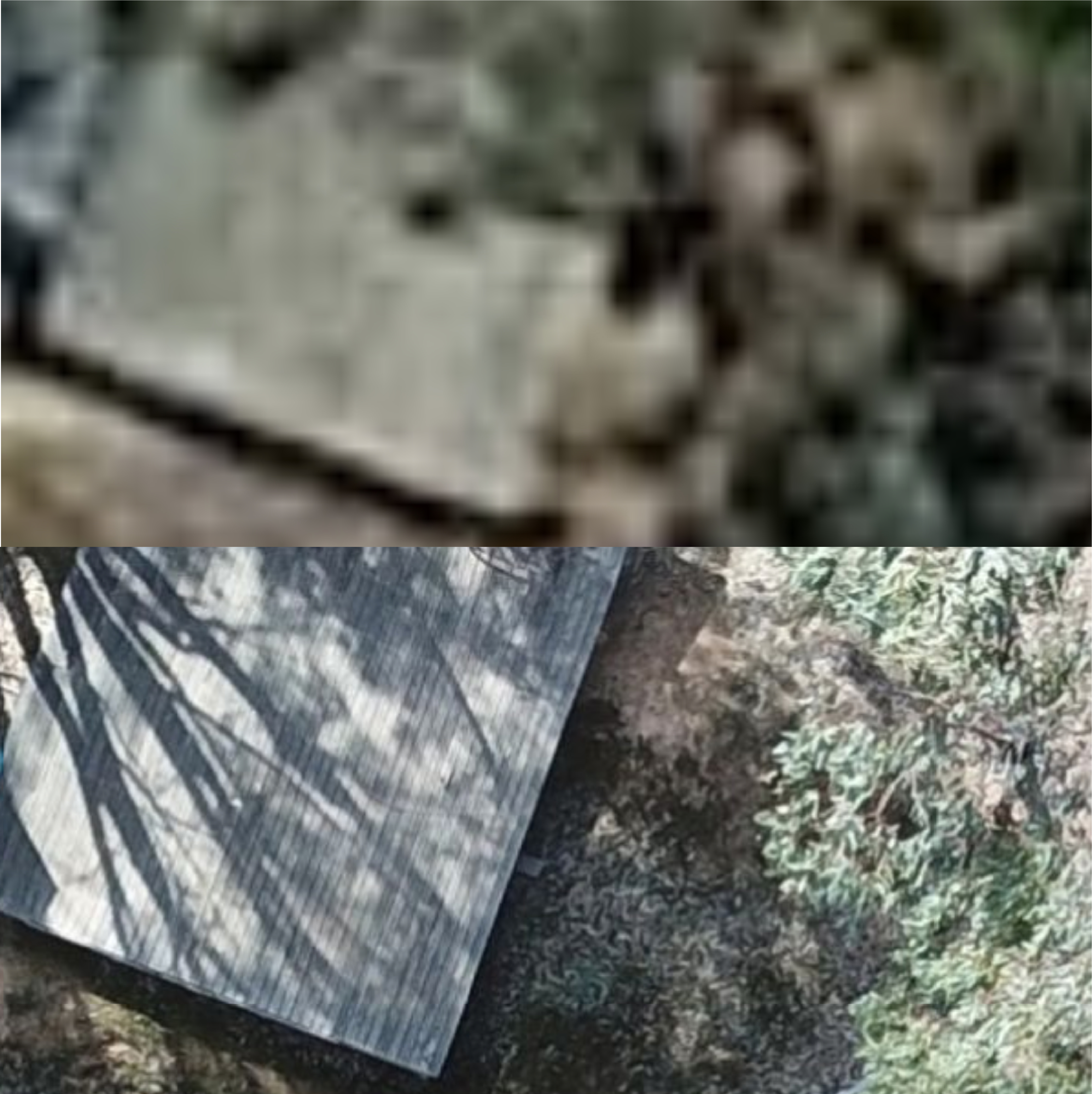
9ha – Top – GoogleEarth Pro – 21st December, 2017 > Bottom – RUAV – 4th September, 2018
REGRARIANS COMPLIES – YOU HAVE TO TOO!!
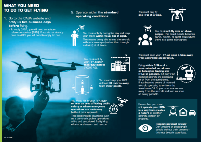
UAV’s share airspace with other regulated aircraft. Its important that you follow your local regulations as the penalties can be severe.
There are some excellent apps available to help you too:
Australia – Can I Fly There?
USA – B4UFLY
UK – Drone Assist
International – Hover
BOOK YOUR FLIGHT TODAY!
Regrarians Ltd. is a proud partner of DroneDeploy’s Flylanthropy program
![]()