In 2014 this site was the host of our first ever 10 day Regrarians Professional Farm Planning & Development Training — now known as the #REX (see www.REX10.org for more info).
Attended by 15 professional land managers and designers from all over the world and held in an old (unimproved) sheep shed, this event was one of the best we’ve been involved with — especially when you consider what the participants have gone on to do using the Regrarians Platform.
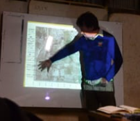
In this film (thanks to Charl Crous!) we see Regrarians’ Darren J. Doherty present (on Day 10) his final concept plan for this 233ha (577 acre) holding in central Victoria, Australia.
Now in February of 2016 you can follow progress on this design as we develop the digital concept planning process following the #RegrariansPlatform — again with the input of many of the graduates of this May 2014 program.
BRIEF:
#1Climate — broad brief is to create a plan for this family to regenerate this landscape which is currently used for sheep grazing and some winter cereal production. They wish to initially install the water and fencing systems necessary to support a transition to #HolisticPlannedGrazing and #PastureCropping
450-500mm annual rainfall with 60-70% falling over March:September (Autumn:Spring) — Maximum summer temperatures 45ºC and winter minimum -3-4ºC. 30-60 frosts per annum with no snowfall. Winds are predominantly south westerly with hot summer winds from north west.
#2Geography — this 233ha (577 acre) site is 30 mins from Bendigo (120K) and 2 hours from Melbourne (4.5M). Its gently undulating with 20m of fall across the whole site and slopes of 1-5º. Surface geology is Ordovician marine-based sediments (500-550 mya) with the alluvium of this parent material found deposited in valleys — soil depth between 1-3.5m before rock is encountered.
This 10cm interval contour map (prepared by FarmingIT) indicates the shape of the landscape and we’ve draped this over a GoogleEarth satellite image dated from January 2014
Please follow the progress of this design phase HERE

