
 #2Geography in the #RegrariansPlatform® — our first planning project for 2017 — Holstons Pastoral Co is 1000ha (2500ac) property near Buchan in Gippsland, VIC, AU. Here we are starting things off with the #RegrariansGeography analysis — this is in part adapted from the late P.A. Yeomans Keyline® Geographic and Geometric analysis — a consideration in the ‘Landshape’ factor of the ‘Keyline Scale of Permanence’.
Regrarians farm planner and designer Georgi Pavlov (Георги Павлов), who does much of our CAD, digital rendering and cartographic work, we’ve been able to develop the following map layers:
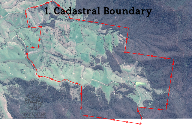
1. Cadastral boundary
2. Smallest contours — between 10-100cm (according to slope)
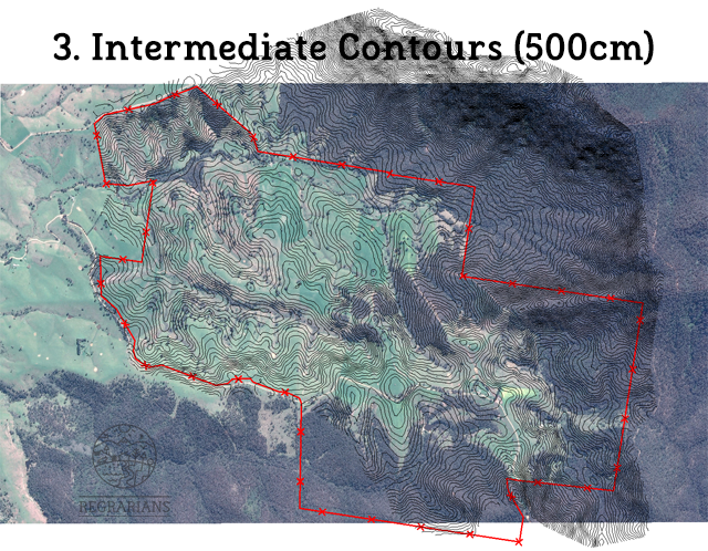
3. Intermediate contours — between 100-500cm (according to slope)
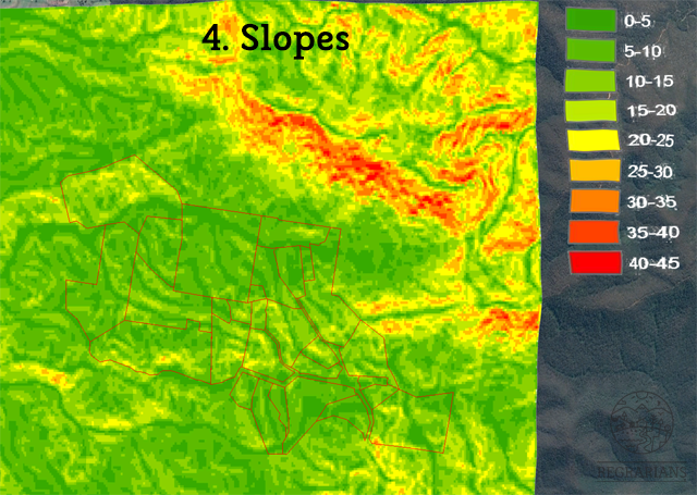
4. Slopes — 0-5˚, 5-10˚, 10-15˚, 15-20˚, 20-25˚, 25-30˚, 30-35˚, 35-40˚, 40-45˚, 45˚+
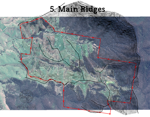
5. Main Ridges
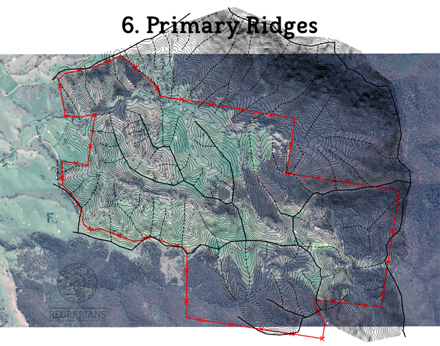
6. Primary Ridges
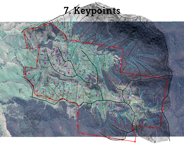
7. Keypoints
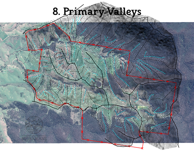
8. Primary Valleys
9. Secondary Valleys
10. Creeks & Rivers
11. Primary Land Units (PLU)
12. PLU Area + High/Low/Average Catchment Yield + Peak Flows
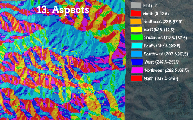
13. Aspects
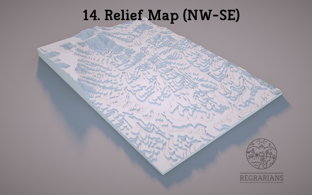
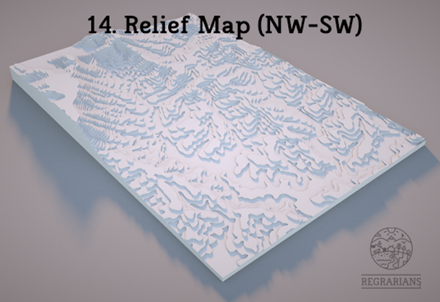
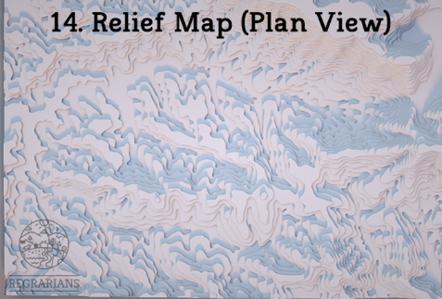
14. Relief Map — 2-3 aspects plus a plan view
15. SketchFab Map
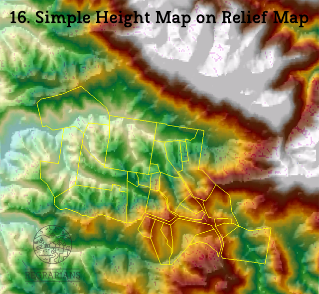
16. Simple Height Map on Relief Map
See many of these map layers below:


Want a similar package of maps to kick off your #LandPlanning project? Contact us and lets see how we can help!
#GeniusOfKeyline #RegrariansGeography #PlanTrainShow
Keyline® is the registered trademark of Ken B. Yeomans