Yandoit Farm
Dja Dja Wurrung Country, Yandoit, Victoria, Australia
Whole Farm Plan | Lifestyle | Grazing | WWOOFing
Topo Survey | Layout Design | Earthworks
@yandoitfarm
37°13'24.26"S, 144° 5'35.92"E | 297m ASL | 598mm Avg. Rainfall
From about 2008 our late and dear friend Dan Palmer (1974-2022) had been spending time with us to increase his skills when it came to farm landscape & enterprise planning. It was during that time that we introduced him to ‘Holistic Management’ and he decided to embed these practices into his design work with VEG and through his extension work at ‘Making Permaculture Stronger’ & ‘Holistic Decision Making’.
In 2012 Lisa and Michael Jackson were able to acquire what they then called, ‘Yandoit Farm’. Lisa is a registered nurse and Michael was a project manager in the construction industry in Melbourne and they were looking to develop a functional ‘lifestyle farm’ on what was a run-down 140 acre grazing block.
This picturesque site fronts a north-south run of Larni Barramal Yaluk (which replaced the racially offensive colonial name of ‘Jim Crow Creek’ in 1923) and is shadowed to its south east by the regionally iconic and culturally significant Lalgambuk (Mount Franklin). The site is predominantly a floodplain which is framed to its west by low stony rises of ordovician sediments and a steeply rising plateau of quaternary volcanics which flowed down the creek from the eruption of Lalgambuk around 450,000 years ago. Lava flows across the region covered many creeks and rivers and when gold was ‘discovered’ in the region in 1851, mining of the buried streams ensued and the flats at Yandoit Farm have numerous remnants of these activities. A water race to support sluicing is another prominent feature from those times.
Owing to relative simplicity of the topography and that the majority of the infrastructure was decrepit, the development of a farm landscape plan was relatively rapid. Decades of experience in designing and developing many sites using ‘The Keyline® Plan’ as the framework definitely helps this process and Dan revelled in this process, capturing part of the concept planning in this video and then going on to write two expansive articles comparing this process with that of famed architect Christopher Alexander (Part One & Part Two).
Another highlight of this project was early on where (in 2012) we organised Bendigo surveyor Colin Thomas (of Landform Surveys)to conduct a trial precision photogrammetry survey with his new AUD$85K fixed wing drone (an ‘eBee SenseFly’). This proved to be a success and in the years that have followed we have developed our own capabilities in that area at a fraction of that cost.
The next phase of our involvement was the earthworks where we were involved in overseeing the construction of 3 dams, some gradient catchment roads and water conservation channels. For these works we recommended working with my friend and colleague Graeme Jennings, and Dan organised an earthworks course to coincide with these works which Regrarians Darren J Doherty then led.
All in all the works have proved to be very successful and, without fail, every time we bump into Lisa or Michael they always mention how much they love their dams—particularly the one that is adjacent to their building envelope and has become a favourite swimming hole over the last decade. Over that time the farm has also been a favourite ‘WWOOFing’ destination—which is a great fit for Lisa and Michael’s love of festivals and the vibe of restoring the land while enjoying each other’s company is definitely a feature.
-
![Yandoit-Larni Barramal Yaluk-Creek]()
2023 - Yandoit Farm - Larni Barramal Yaluk Creek - Image Credit: Yandoit Farm
-
![Yandoit-House]()
2023 - Yandoit Farm - Old farm shed and dairy converted into homestead - Image Credit: Yandoit Farm
-
![Yandoit-Daz|Dan-2014]()
2014 - Dan Palmer (R) & Darren J Doherty (L) with the forested peak of Lalgambuk in the background and its lava flow plateau rising above the main flood plain - Image Credit: VEG
-
![Yandoit-Geometree-RipperHoe]()
2015 - Yandoit Farm - Yeomans Keyline Plow & 1m wide Sicma rotary hoe - a Regrarians concept (>1997) - Image Credit: Yandoit Farm
-
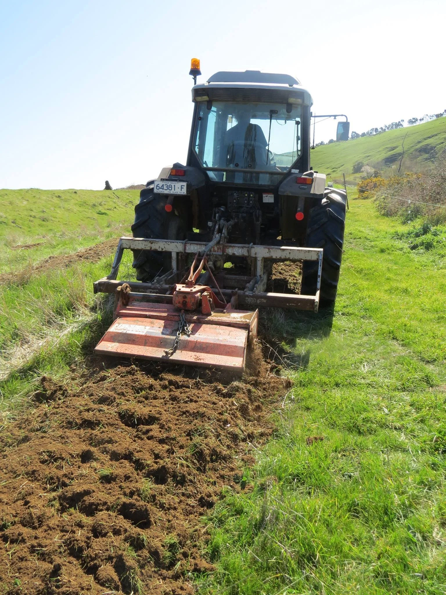
![Yandoit-Geometree-RipperHoe]()
2015 - Yandoit Farm - Yeomans Keyline Plow & 1m wide Sicma rotary hoe in operation - a Regrarians concept (>1997) - Image Credit: Yandoit Farm
-
![Yandoit-Trees-Riparian-2]()
2015 - Yandoit Farm - Riparian tree & shrub planting - Image Credit: Yandoit Farm
-
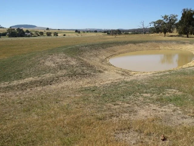
![YandoitDams-BackDam-2014]()
2014 - Yandoit Farm - Back dam starting to fill - Image Credit: Yandoit Farm
-
![YandoitDams-FirstFill-1]()
2016 - Yandoit Farm - Back Dam Filled - Image Credit: Yandoit Farm
-
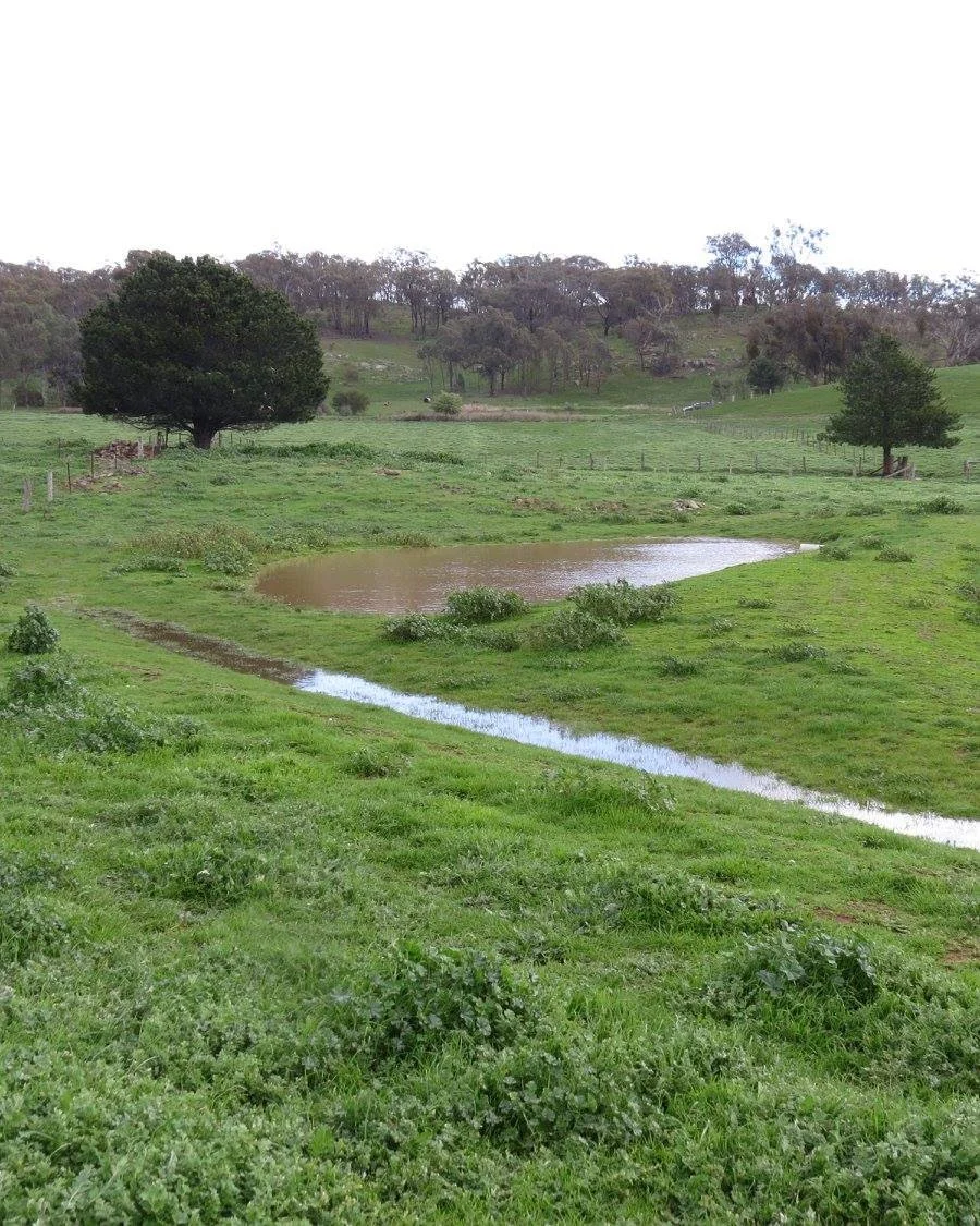
![YandoitDams-FirstFill-2]()
2016 - Yandoit Farm - Water conservation channel filling old dam - Image Credit: Yandoit Farm
-
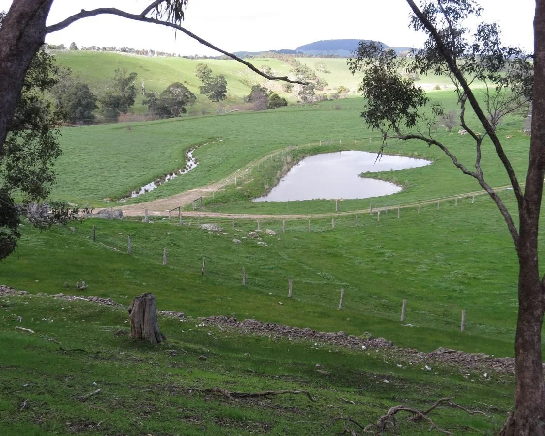
![Yandoit Barrier Dam First Fill]()
2016 - Yandoit Farm - House Dam - Image Credit: Yandoit Farm
-
![YandoitDams-FirstFill-4]()
2016 - Yandoit Farm - House Dam, historic Liepold water race below dam with Lalgambuk and its lava flow plateau in the background - Image Credit: Yandoit Farm
-
![YandoitDams-FirstFill-5]()
2016 - ‘Jake’ standing in the Back dam’s full water level—onto grass as is our preference - Image Credit: Yandoit Farm
-
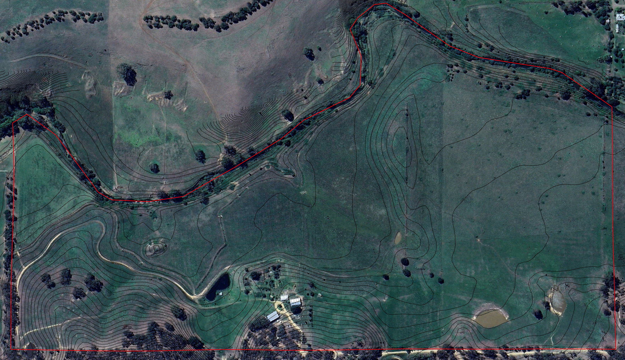
![YandoitFarm-2024-Satellite]()
2024 - Yandoit Farm Satellite Topo Map - Image Credit: Google Earth Pro (Maxar) & Victorian Government
-
![]()
2014 - Yandoit Farm - Keyline Pattern Cultivation by Regrarians Darren J Doherty - Image Credit: VEG
-
![]()
2014 - Yandoit Farm - L-R - David Holmgren, Dan Palmer (†), Darren J Doherty, Adam Grubb during Regrarians Earthworks Course - Image Credit: VEG
-
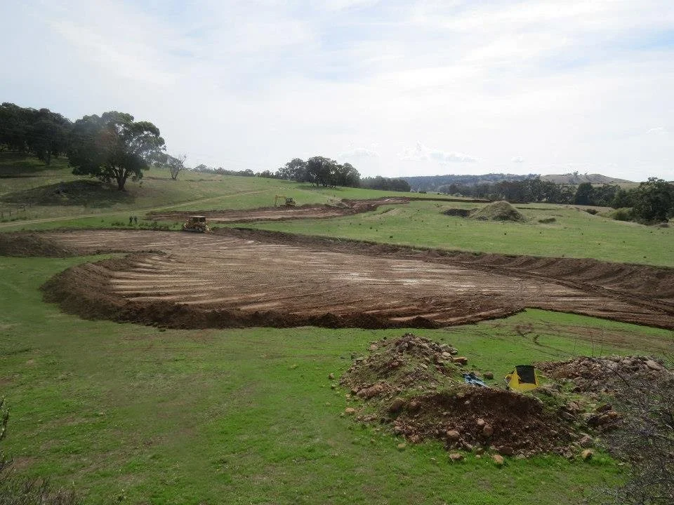
![Yandoit Barrier dam topsoil stripping]()
2014 - Yandoit Farm - Topsoil stripping of house dam site and gradient catchment road - Image Credit: VEG
-
![YandoitRAP1 - Gradient Catchment Road]()
2014 - Yandoit Farm - Topsoil stripping of gradient catchment road at 2nd entrance - Image Credit: VEG
-
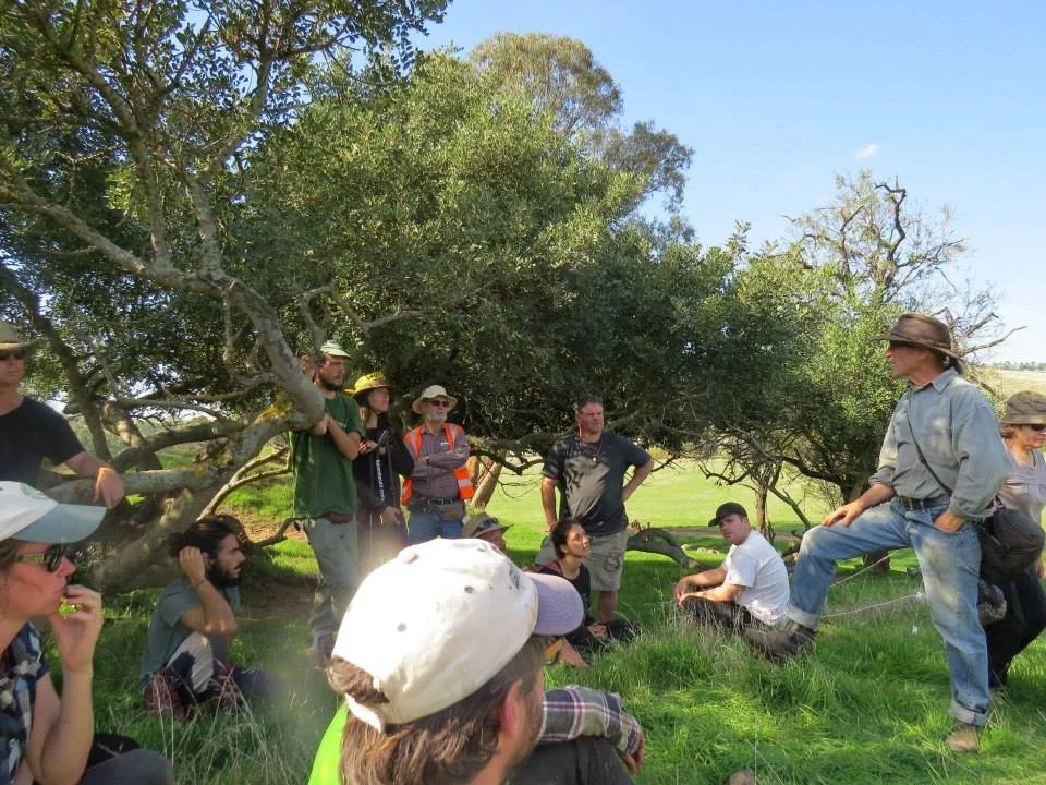
![YandoitRAP1_15]()
2014 - Yandoit Farm - David Holmgren discussing ‘Landscape Reading’ during Regrarians Earthmoving Course (under remnant Ceratonia siliqua {carob}) - Image Credit: VEG
-
![2014 - Yandoit Farm - Geotechnical investigation of back dam site (L-R Robin and Dan Palmer) - Image Credit: Regrarians (Darren J Doherty)]()
2014 - Yandoit Farm - Geotechnical investigation of back dam site (L-R Robin and Dan Palmer) - Image Credit: Regrarians (Darren J Doherty)
-
![YandoitRAP1_12]()
2014 - Yandoit Farm - Darren J Doherty describing earthworks program to Regrarians Earthworks Course participants - Image Credit: VEG
-
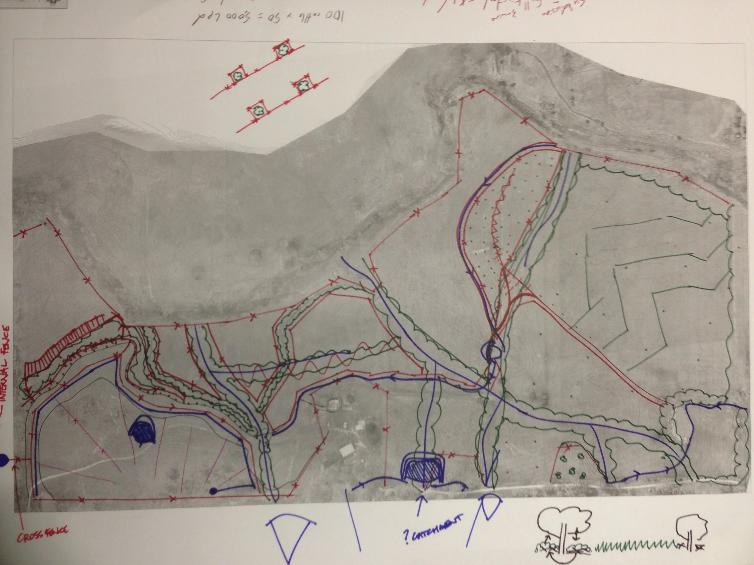
![EarthworksSketchV1]()
2014 - Yandoit Farm - ‘Earthworks Phase One’ Plan - Image Credit: VEG (Dan Palmer)
-
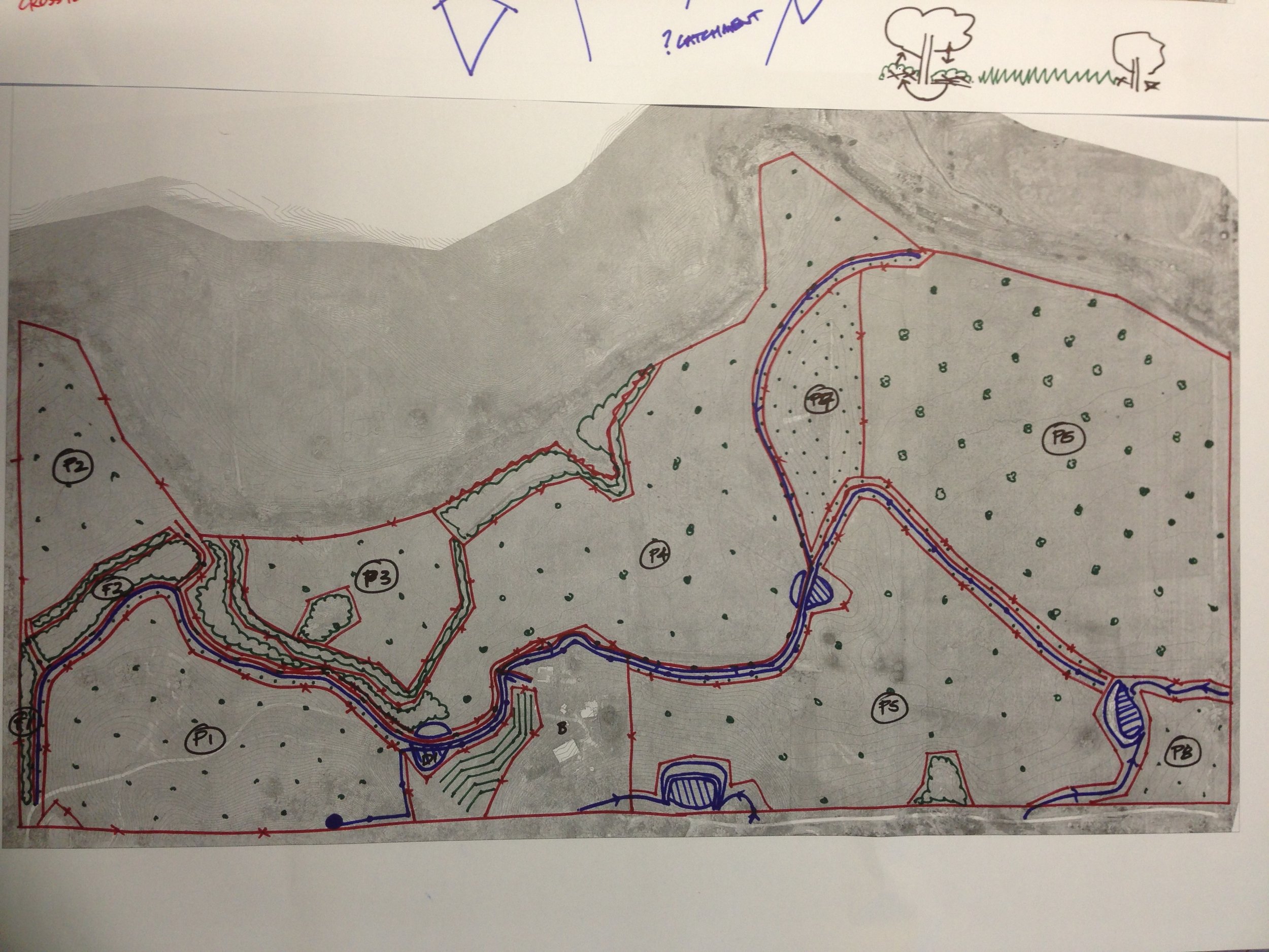
![20130930_ConceptPlanV1]()
2013 - Yandoit Farm - Concept plan draft V1 by Regrarians Darren J Doherty - Image Credit: Regrarians
-
![]()
2013 - Yandoit Farm - Concept plan draft V2 by Regrarians Darren J Doherty - Image Credit: Regrarians
-
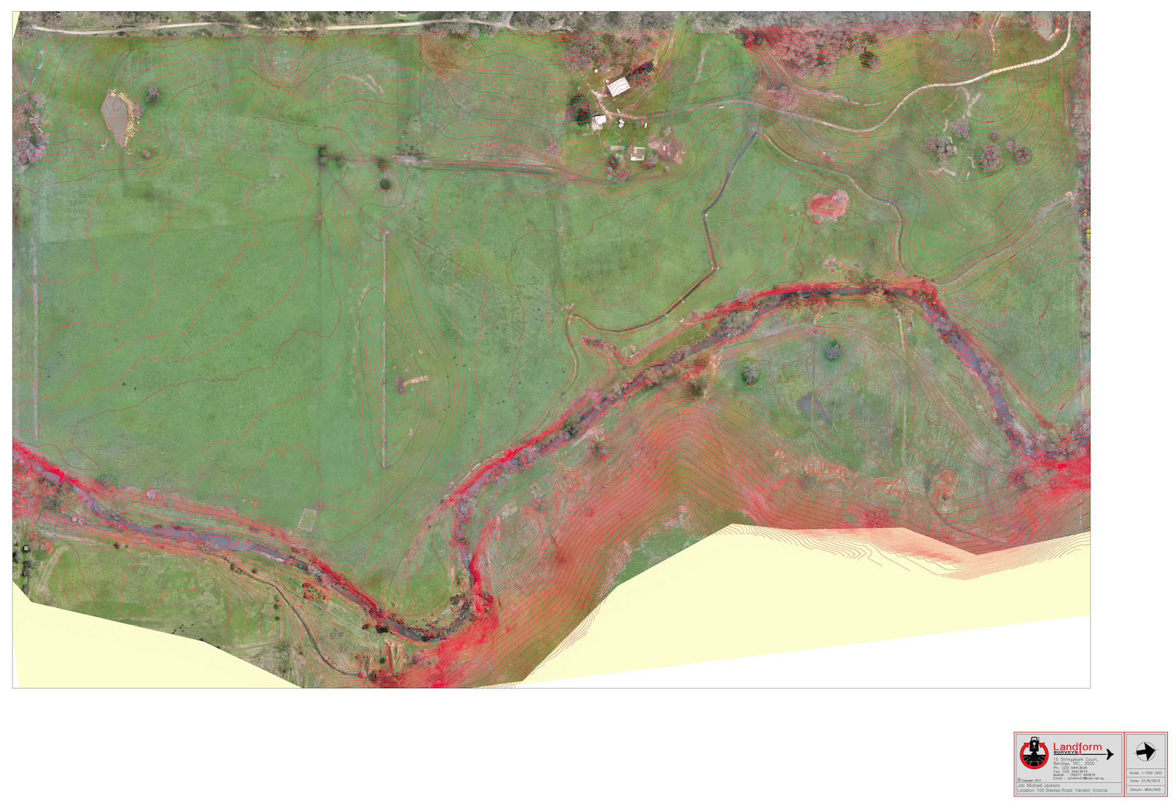
![2013-UAV-AerialTopo-ColinThomas]()
2013 - Yandoit Farm - Precision photogrammetry-derived aerial photo & topographic plan (from eBee Sensefly drone) - Image Credit: Landform Surveys (Colin Thomas)