Earthworks
Water storage dams/ponds, water conservation & drainage systems, roads, building sites
Planning
Construction
Supervision
Over a number of weeks during the hot & dry summer of 1982-3, Regrarians’ founder and principal Darren J Doherty built his first farm dam with his maternal Grandfather, Frank B. Dole Snr. (1915-2001) on the family farm ‘Myrtledale’ using a 1953 (Grey) Ferguson TEA-20 tractor (28hp) and a ‘Ferguson System’ subsoiler and 0.2yd³ (0.15m³) scoop. This was the first of many that Darren has been involved in designing and building, the continuation of generations of the Dole family’s professional earthmoving services across the Bendigo district.
Humans have been engaged surface water conservation earthworks for millennia and in this era of diverse and powerful earthmoving machinery these works can be built in a fraction of the time Darren experienced that hot summer over 4 decades ago.
Since 1993 our development planning work is built around P.A. Yeomans’ revolutionary ‘Keyline® Plan’ and its simple workflow of geographic analysis that is followed by designing the placement of water conservation infrastructure. While we understand and embed the techniques and strategies of other water management methodologies, it is always framed within the utter logic of ‘The Keyline® Plan’.
Any planning process always starts with a range of contexts; human, enterprise, meteorological, regulatory and geographic. If it didn’t then the outcomes of a planning process would be idealistic at best and financially disastrous at its worst.
Our mantra of being ‘Strategic, Pragmatic and Incremental’ (SPI) is particularly important when it comes to earthmoving due to their permanence and high cost. With that we have always understood they are works of engineering and so we apply due diligent processes to their planning, development and management.
With this we complete catchment analysis, peak flow volume calculations, geotechnical investigations and 3D CAD plans to determine the optimum placement, integration and cost-effectiveness of the water conservation and reticulations works we work on for you. It has a cost, however the value proposition is having outcomes which are durable and will generally save money that would otherwise be spent.
Check out our ‘Planning Element Costings’ page for information on the industry-leading pro rata costs of having Regrarians work with you on your water conservation and reticulation plans.
-
![2024 Eppalock ridge dam CAD satellite]()
2024 - Eppalock (VIC, AU) - Ridge dam CAD plan overlay on satellite image - Image Credit: Regrarians (Georgi Pavlov), Google Earth Pro (Maxar)
-
![2021 Ridge dam CAD]()
2021 - Eppalock (VIC, AU) - Ridge dam CAD plan - Image Credit: Regrarians (Georgi Pavlov)
-
![2024 Eppalock Barrier dam CAD satellite]()
2024 - Eppalock (VIC, AU) - Barrier dam CAD plan overlay on satellite image - Image Credit: Regrarians (Georgi Pavlov), Google Earth Pro (Maxar)
-
![2021 Eppalock Barrier Dam CAD]()
2021 - Eppalock (VIC, AU) - Barrier dam CAD plan - Image Credit: Regrarians (Georgi Pavlov)
-
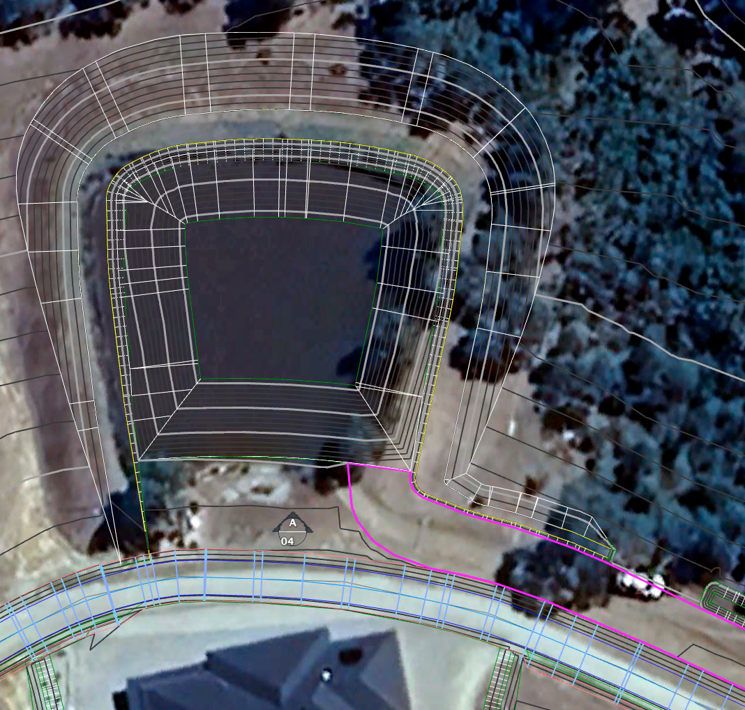
![2024 Eppalock Dams gradient catchment road CAD satellite]()
2024 - Eppalock (VIC, AU) - Ridge dam, barrier dam, connected overflow channel, house site, gradient catchment road CAD plan overlay on satellite image - Image Credit: Regrarians (Georgi Pavlov), Google Earth Pro (Maxar)
-
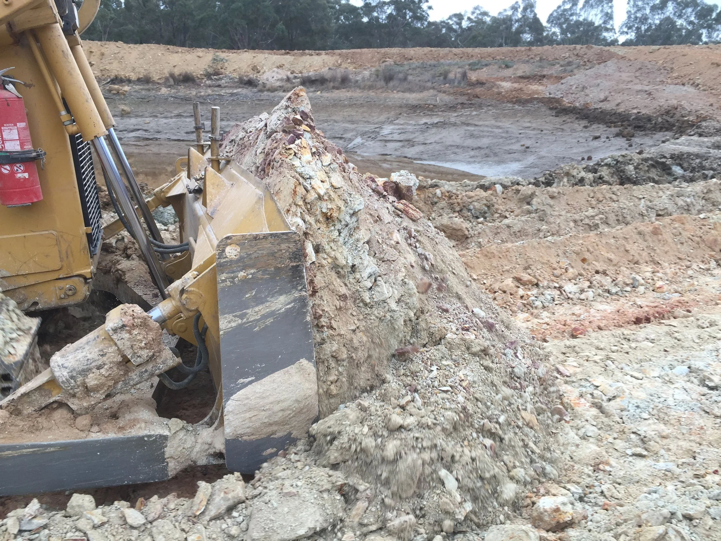
![Eppalock Caterpillar D6T bulldozer track rolling]()
2010 - Eppalock (VIC, AU) - Track rolling (vibration compacting) with a Caterpillar D6T bulldozer during construction of a ridge dam - Image Credit: Regrarians
-
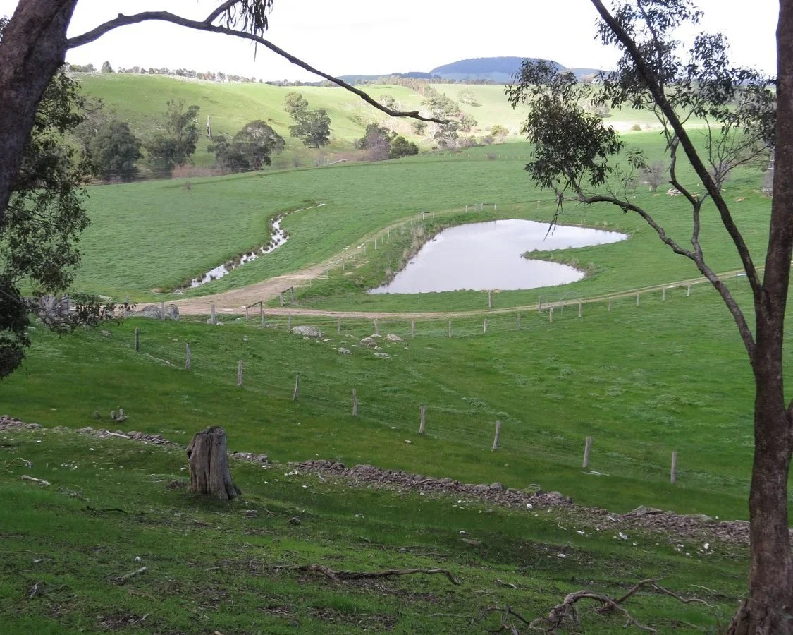
![2015 Contour Dam]()
2015 - Myrtledale (VIC, AU) - Contour dam constructed in 1982-3 by Frank B. Dole Snr. and Darren J Doherty - Image Credit: Regrarians (Darren J Doherty)
-
![2015 Contour dam]()
2015 - Myrtledale (VIC, AU) - Contour dam constructed in 1982-3 by Frank B. Dole Snr. and Darren J Doherty (note trees should not be allowed to grow on an embankment that is holding back water - Image Credit: Regrarians (Darren J Doherty)
-
![Ferguson Earth Scoop]()
The Ferguson Earth Scoop as used to build a contour dam at ‘Myrtledale’ in 1982-3 - Image Credit: The Ferguson Club Journal
-
![Ferguson subsoiler]()
Ferguson Subsoiler as used to build a contour dam at ‘Myrtledale’ in 1982-3 - Image Credit: The Ferguson Club Journal
-
![2001-MannaHill-HouseCut]()
2001 - Manna Hill Estate (VIC, AU) - House cut (including terraces) with 20t excavator and rock breaker attachment - Image Credit: Regrarians (Darren J Doherty)
-
![2022 Manna Hill Estate house cut terraces]()
2022 - Manna Hill Estate (VIC, AU) - House cut and terraces 20 years after excavation - Image Credit: Regrarians (Darren J Doherty)
-
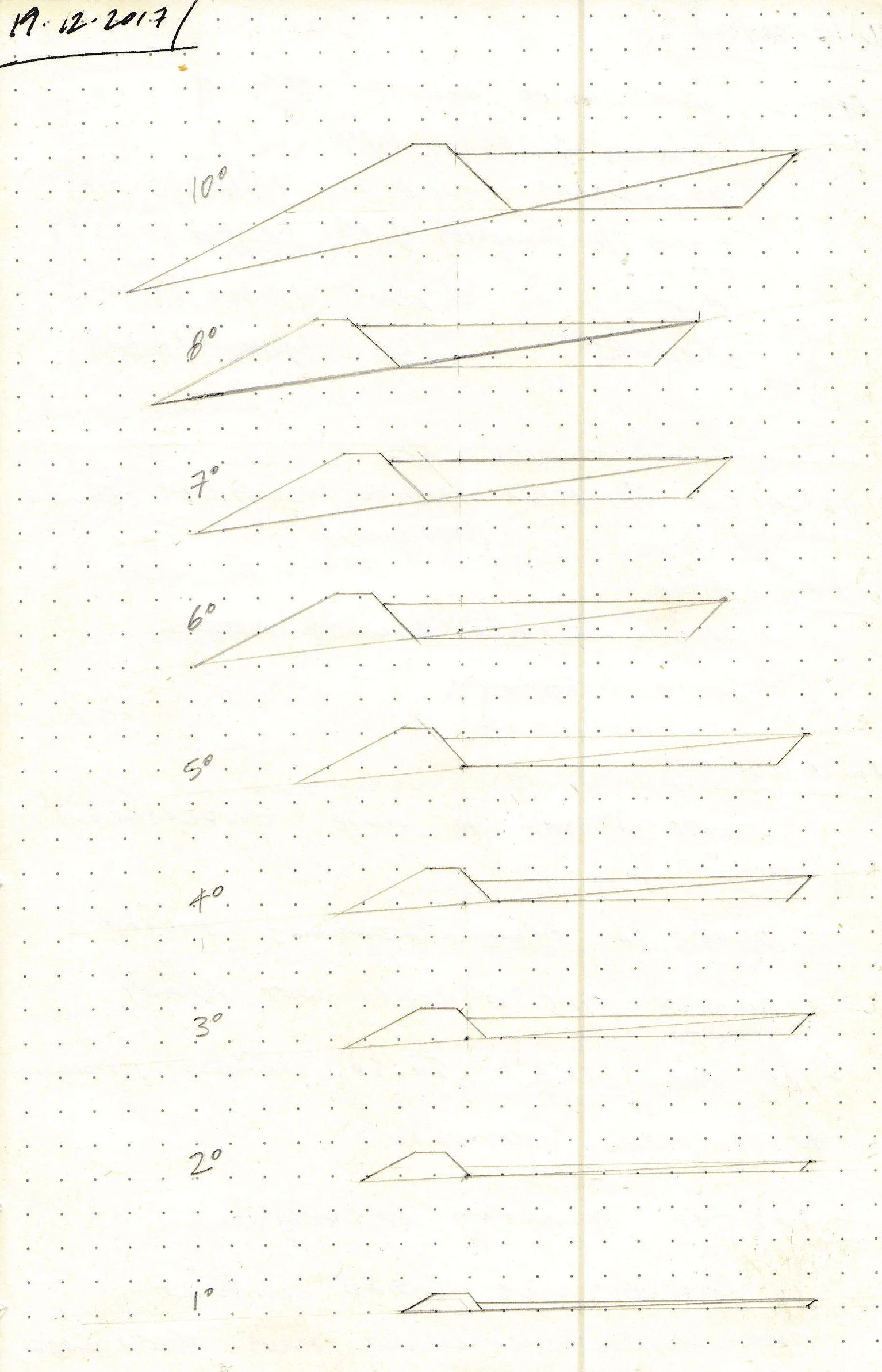
![Landscape Slope Dam Cross Sections]()
2017 - Illustration to indicate impact of different landscape slope angles on the embankment, excavation and water storage volumes - Image Credit: Regrarians (Darren J Doherty)
-
![2015 Saddle Dam Concepts]()
2015 - Holstons Station (VIC, AU) - Saddle dam concept designs - Image Credit: Regrarians (Darren J Doherty)
-
![Back contour dam clean out]()
2025 - Longlea (VIC, AU) - Contour dam clean out infographic - Image Credit: Regrarians (Darren J Doherty)
-
![2025 contour dam clean out]()
2025 - Longlea (VIC, AU) - Contour dam clean out infographic - Image Credit: Regrarians (Darren J Doherty)
-
![2025 - tank dam clean out]()
2025 - Longlea - Tank dam clean out infographic - Image Credit: Regrarians (Darren J Doherty)
-
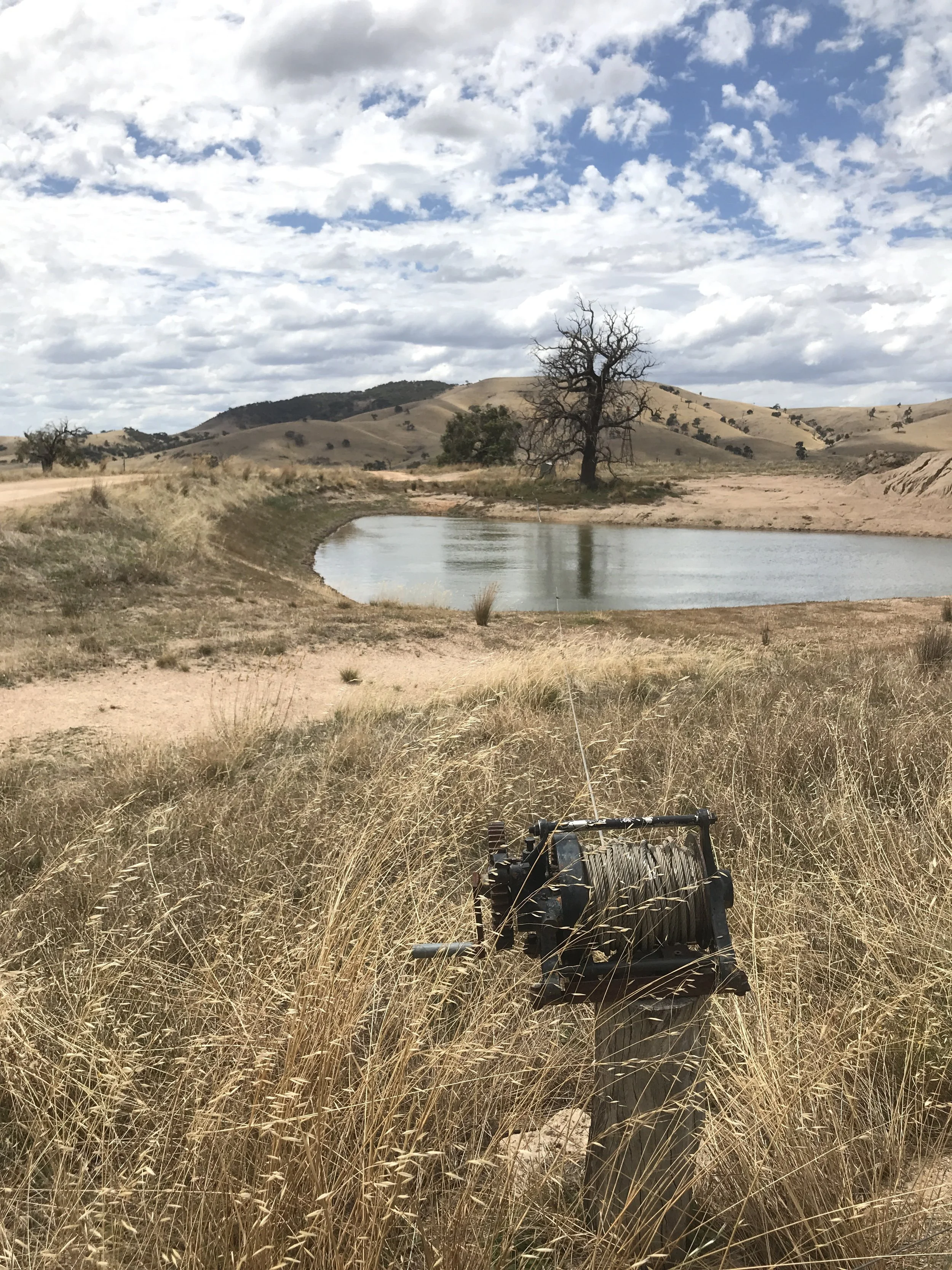
![2018 suction pipe suspension cable winch]()
2018 - McIvor Farm Foods (VIC, AU) - Cable winch for regulating the depth of a suction pipe intake attached to the cable - Image/Concept Credit: Regrarians (Darren J Doherty)
-
![2024 interlace Barrier dam CAD Sateliite]()
2024 - Interlace (NY, USA) - Barrier dam CAD design overlay on satellite image - Image Credit: Regrarians (Georgi Pavlov), Google Earth Pro (Maxar)
-
![2024 Interlace barrier dam CAD satellite]()
2024 - Interlace (NY, USA) - Barrier dam CAD design overlay on satellite image - Image Credit: Regrarians (Georgi Pavlov), Google Earth Pro (Maxar)
-
![2024 - Interlace barrier dams gradient catchment roads]()
2024 - Interlace (NY, USA) - Barrier dams, wetland crossing dam, gradient catchment road and ridge road CAD design overlay on satellite image - Image Credit: Regrarians (Georgi Pavlov), Google Earth Pro (Maxar)
-
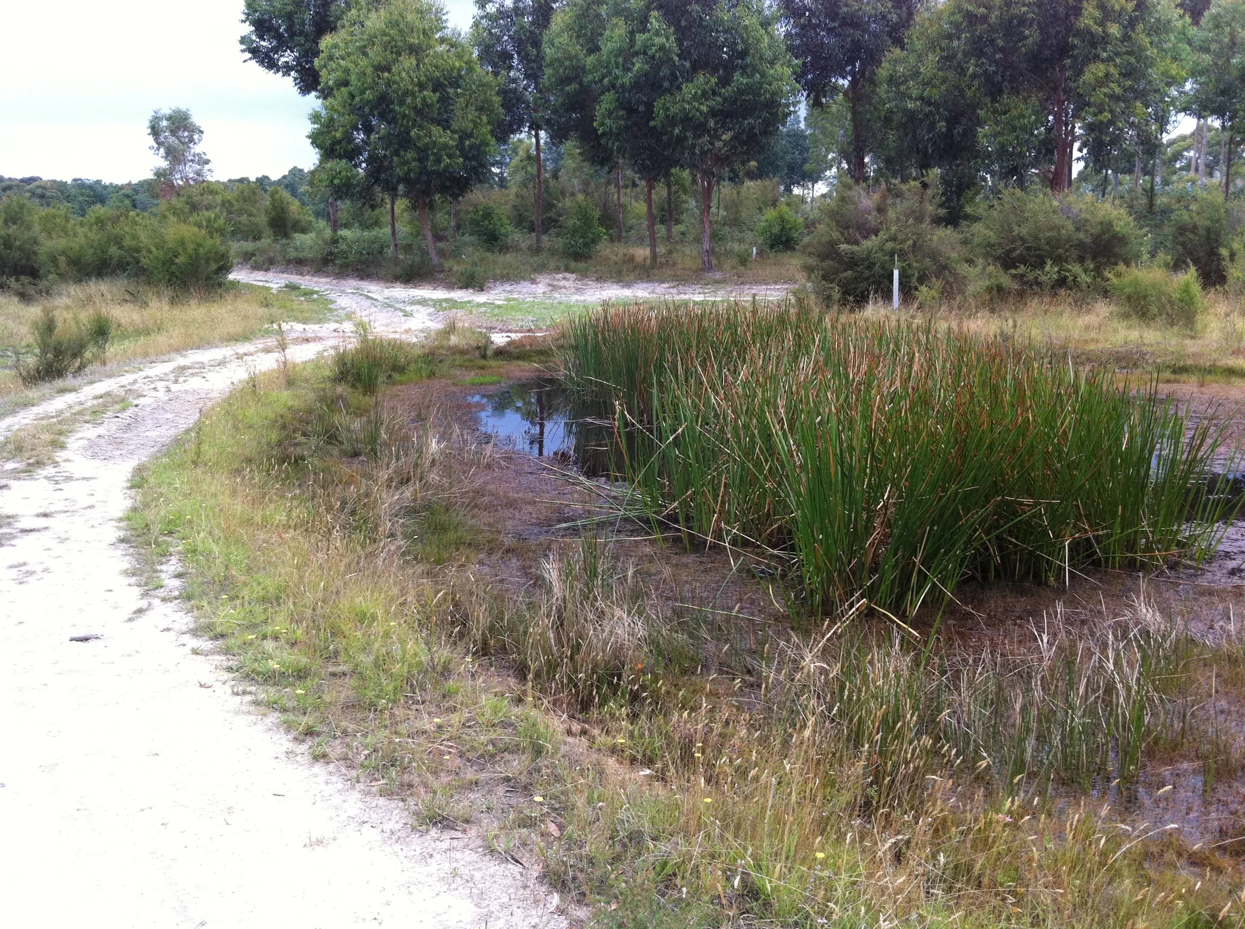
![Nullavale 2005 Ridge dam water conservation channel]()
2005 - Nulla Vale (VIC, AU) - Ridge dam and water conservation channels (Image Credit: Regrarians (Darren J Doherty)
-
![Nullavale 2001 Ridge dam lockpipe gatevalve]()
2001 - Nulla Vale (VIC, AU) - Ridge dam Ø200mm polyethylene lockpipe & cast iron gate valve - Image Credit: Regrarians
-
![2001 Nulla Vale ridge dam water conservation channel]()
2001 - Nulla Vale (VIC, AU) - Ridge dam and water conservation channel - Image Credit: Regrarians (Darren J Doherty)
-
![2007 Nulla Vale contour crossing dam]()
2007 - Nulla Vale (VIC, AU) - Contour crossing dam - Image Credit: Regrarians (Darren J Doherty)
-
![1996 - Woodbrook ridge dam]()
1996 - Harcourt North (VIC, AU) - Ridge dam - Image Credit: Regrarians (Darren J Doherty)
-
![2013 McIvor Farm Foods pigs sealing barrier dam]()
2013 - McIvor Farm Foods (VIC, AU) - Pigs being used to seal a dam with a high proportion of coarse granitic sand - Image Credit: McIvor Farm Foods
-
![2011 Dalpura Wetland crossing dam]()
2011 - Dalpura (VIC, AU) - Wetland crossing dam that took a Caterpillar D5 bulldozer 2 hours to construct - Image Credit: Regrarians (Darren J Doherty)
-
![2011 Dalpura Water conservation channel]()
2011 - Dalpura (VIC, AU) - Water conservation channel for carrying public road runoff to a barrier dam - constructed with a Caterpillar 12G grader - Image Credit: Regrarians (Darren J Doherty)
-
![2011 Dalpura water conservation channel]()
2011 - Dalpura (VIC, AU) - Water conservation channel for carrying public road runoff to a barrier dam—mulched with weather-damaged round hay bales - Image Credit: Regrarians (Darren J Doherty)
-
![2014 Yandoit Farm water conservation channel]()
2014 - Dalpura (VIC, AU) - Water conservation channel connecting to barrier dam - Image Credit: Regrarians (Darren J Doherty)
-
![Hōkūnui Dam CAD Plan]()
2016 - Hōkūnui valley dam CAD plan - Image Credit: Alpha Inc.
-
![Hokunui lower dam GCL installation]()
2016- Hōkūnui - Lower valley dam geosynthetic clay liner (GCL) installation - Image Credit: Erik Frost (†)
-
![2025 - Hōkūnui - Upper valley dam, header tank, gradient catchment road & housing]()
2025 - Hōkūnui - Upper valley dam, header tank, gradient catchment road & housing - Image Credit: Hōkūnui
-
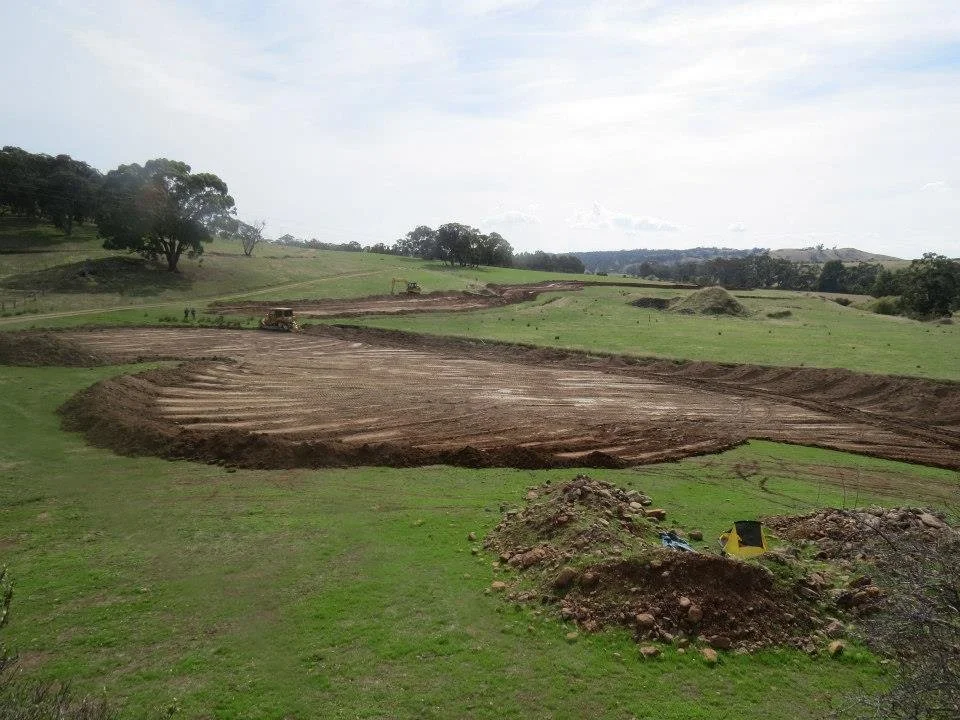
![Yandoit Barrier dam topsoil stripping]()
2014 - Yandoit Farm - Topsoil stripping of house dam site and gradient catchment road - Image Credit: VEG
-
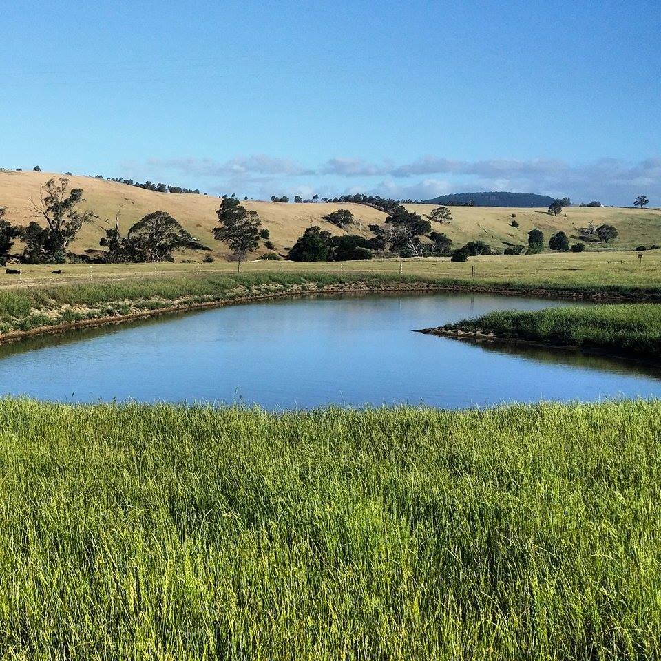
![2014 Barrier Dam]()
2014 - Yandoit Farm (VIC, AU) - Barrier dam 8 months after construction with topsoil growing a good cover of grass - Image Credit: Yandoit Farm
-
![2016 Yandoit Farm Barrier dam filled]()
2016 - Yandoit Farm - House Dam two years after construction with topsoil growing full ground cover - Image Credit: Yandoit Farm