
Regrarians Earth
Regrarians Earth (R-Earth) is a CAD & GIS farm planning application developed by Regrarians Senior Planner, Georgi Pavlov. It has been designed to replace Regrarians' use of AutoCAD Civil 3D, Spatial Manager, QGIS, MapInfo Professional and Google Earth Pro. Lean, intuitive, effective and precise, R-Earth heralds a new era in farm planning for anyone, anywhere.
Want to Learn More?
Please register for these interactive (& recorded) information webinars:
• 29th of April 2026 (Oceania, Asia, Africa, EU) 1800-2000 (AEST+10) - https://cli.re/R-Earth-Z1
• 30th of April 2026 (Americas) 0400-0600 (AEST+10) - https://cli.re/R-Earth-Z2
Lean
Conventional CAD & GIS software gets more and more bloated over time. Optimisation is central to stability and speed. Our software offsers no flashy nonsense or unnecessary fluff. Just the controls that you need to get the job done in the fastest ways possible - right at your fingertips.
Intuitive
It has to be, right? Working directly with 1000’s of land managers has shown us what works. Simple icons, tool tips and hotkeys in an uncomplicated interface.
Effective
Your time and forms of capital are front of mind. R-Earth allows you express your application of both by not beating around the bush.
Precise
Did you know that even the most expensive software measures the earth as if its flat? With R-Earth we provide both 2D and 3D measurements.
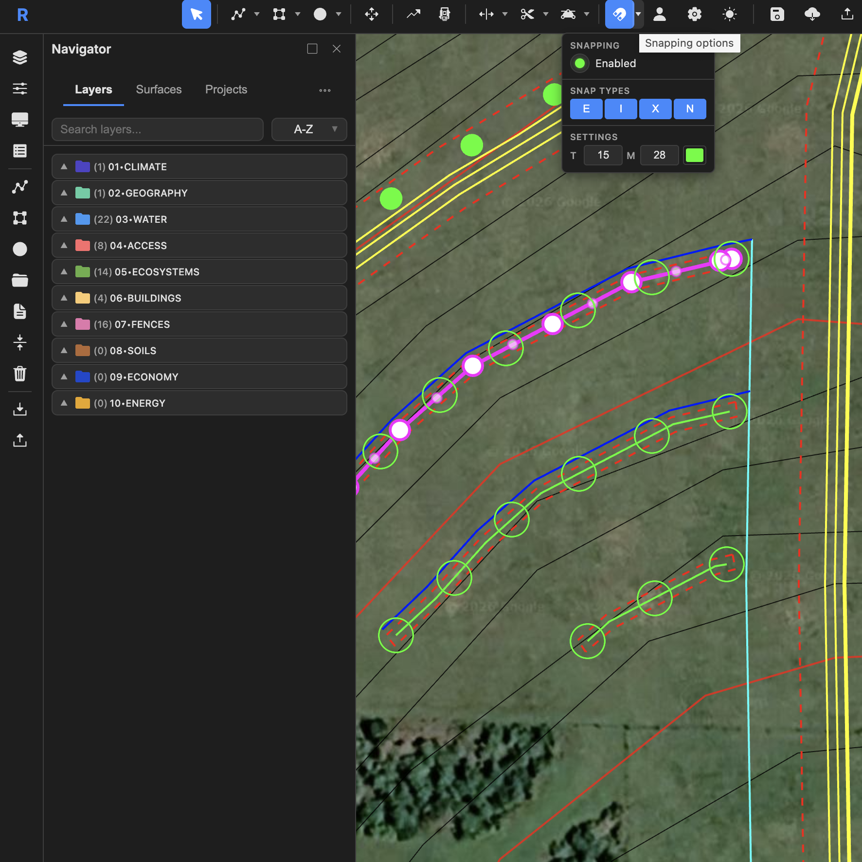
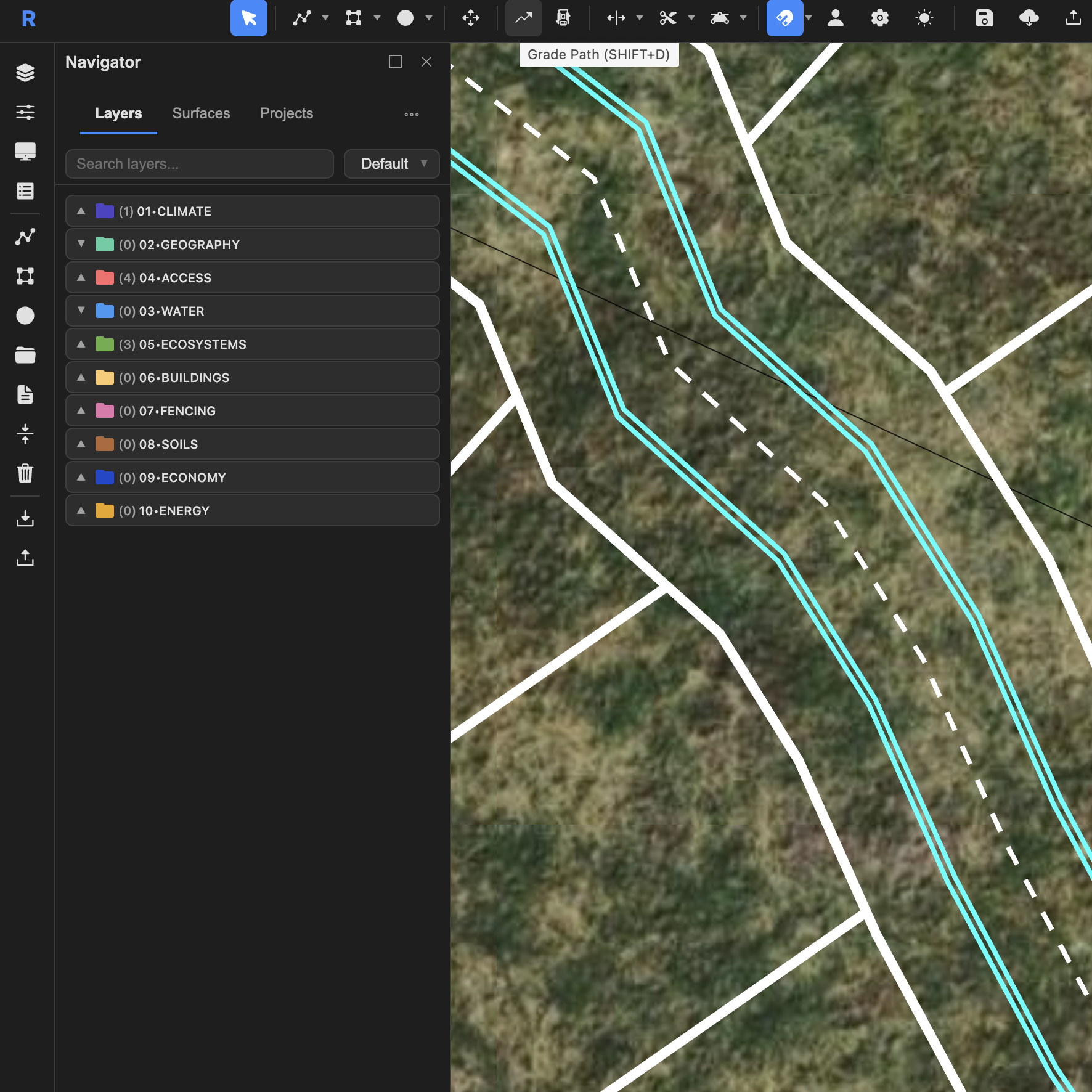
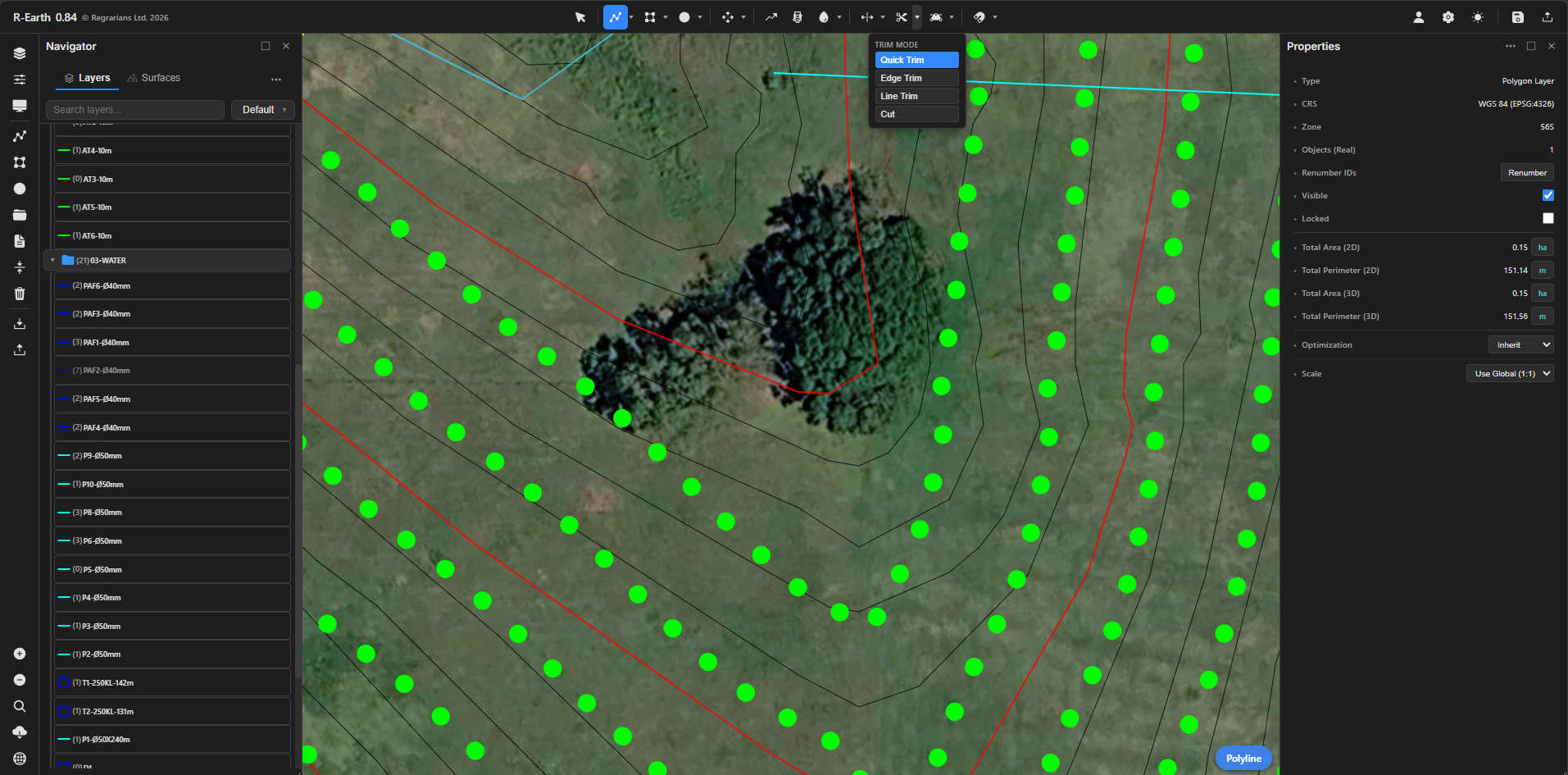
CAD
Polylines, polygons and points. Parallel offsets (with no ‘bow ties’), trim, chamfers & fillets. Vertices, point arrays and snapping!
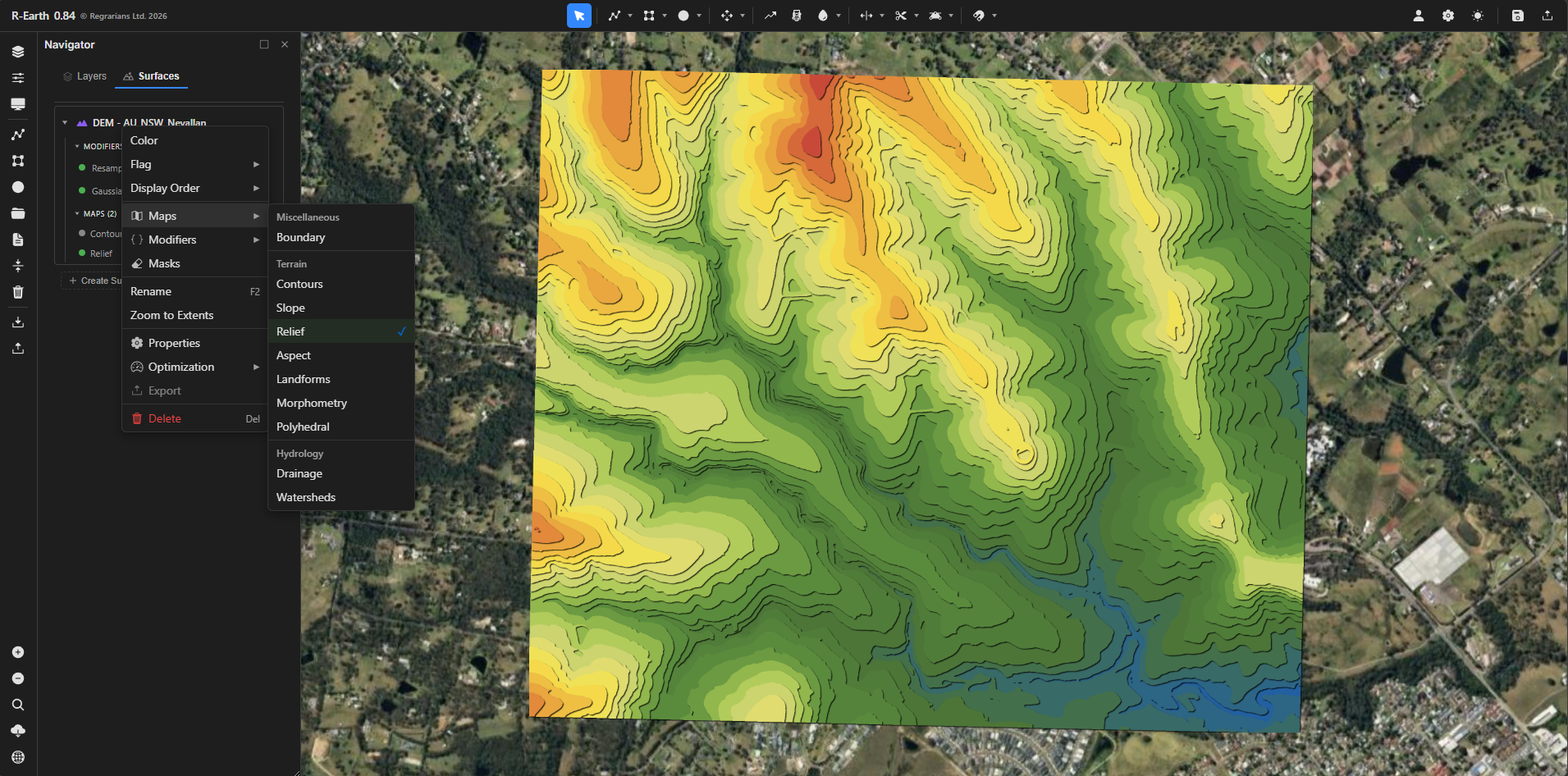
GIS
People love Regrarians Base Map Service so much that we’re integrating it into R-Earth too. The ‘modifiers’ feature allows you to set your own parameters and quickly get the information you need without needing to leave.
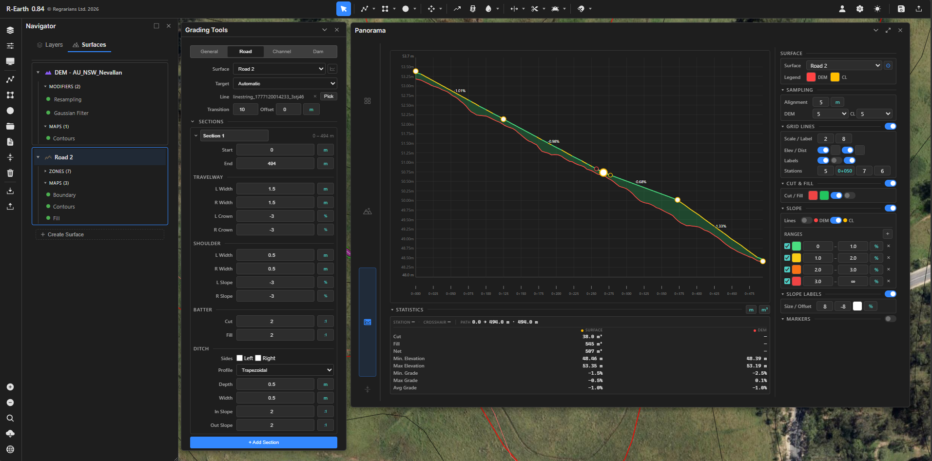
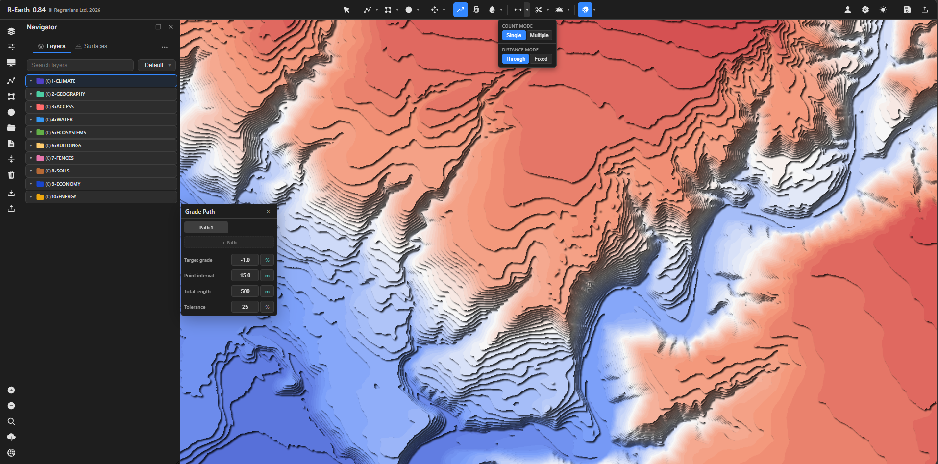
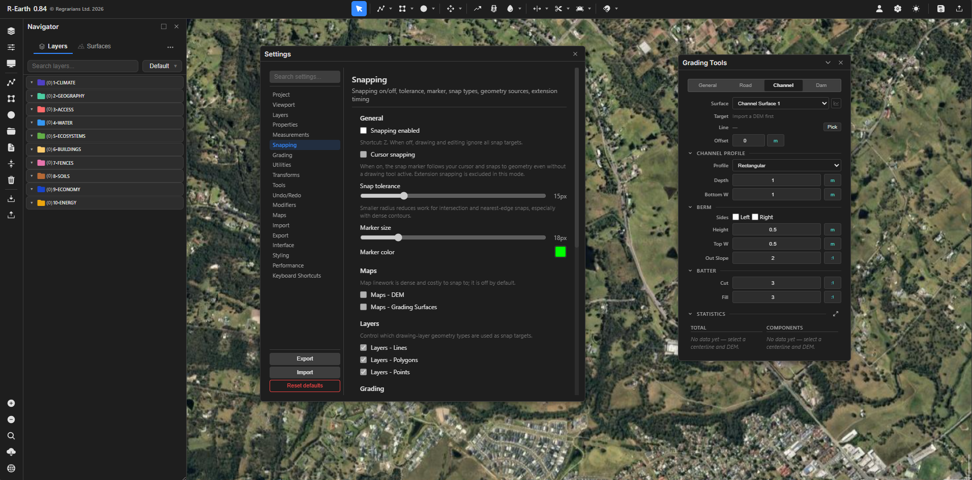
Grading
Cut and fill. Dams (ponds), roads, channels and building sites. Never before has this been so easy. Mark out a centreline (polyline) and with one click turn it into a dam embankment, a road or a channel. Adjust the parameters and get the earthworks volumes. As simple as it can ever be.