RREnders Service
Want to see what your farm will look like in the future? How much shade trees and buildings that have not grown or been built will cast. Communicate with your farm team, community, networks and even the government what the future is going to look like at your place. Maybe you just want a really good wall map that helps your farm management team to locate where everything is.
The experienced team here at Regrarians is here to help with crisp, realistic, affordable and effective illustrations that will reveal the future to everyone!
Over the last decade Regrarians’ Georgi Pavlov has been building an international reputation as a leading farm planner, author and digital illustrator. Georgi and the Regrarians farm planning team are ready to help you develop a range of cost-effective illustrations that suit your needs.
RRenders Products
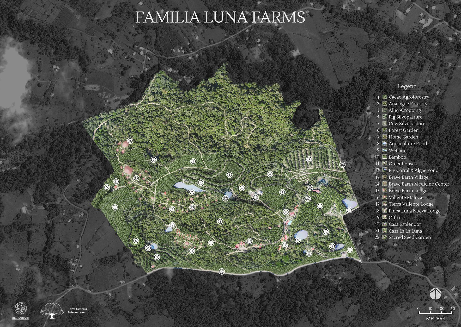
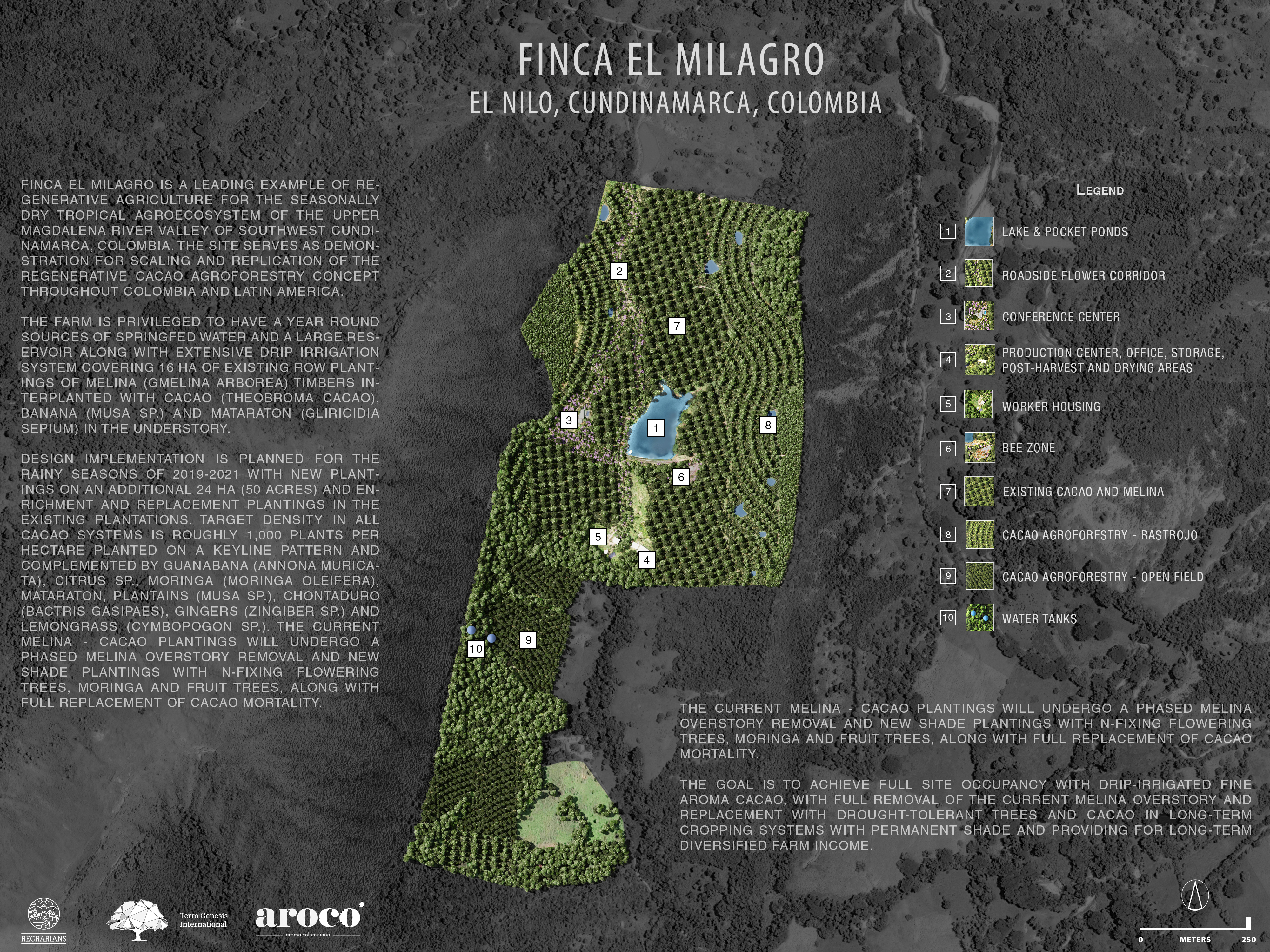
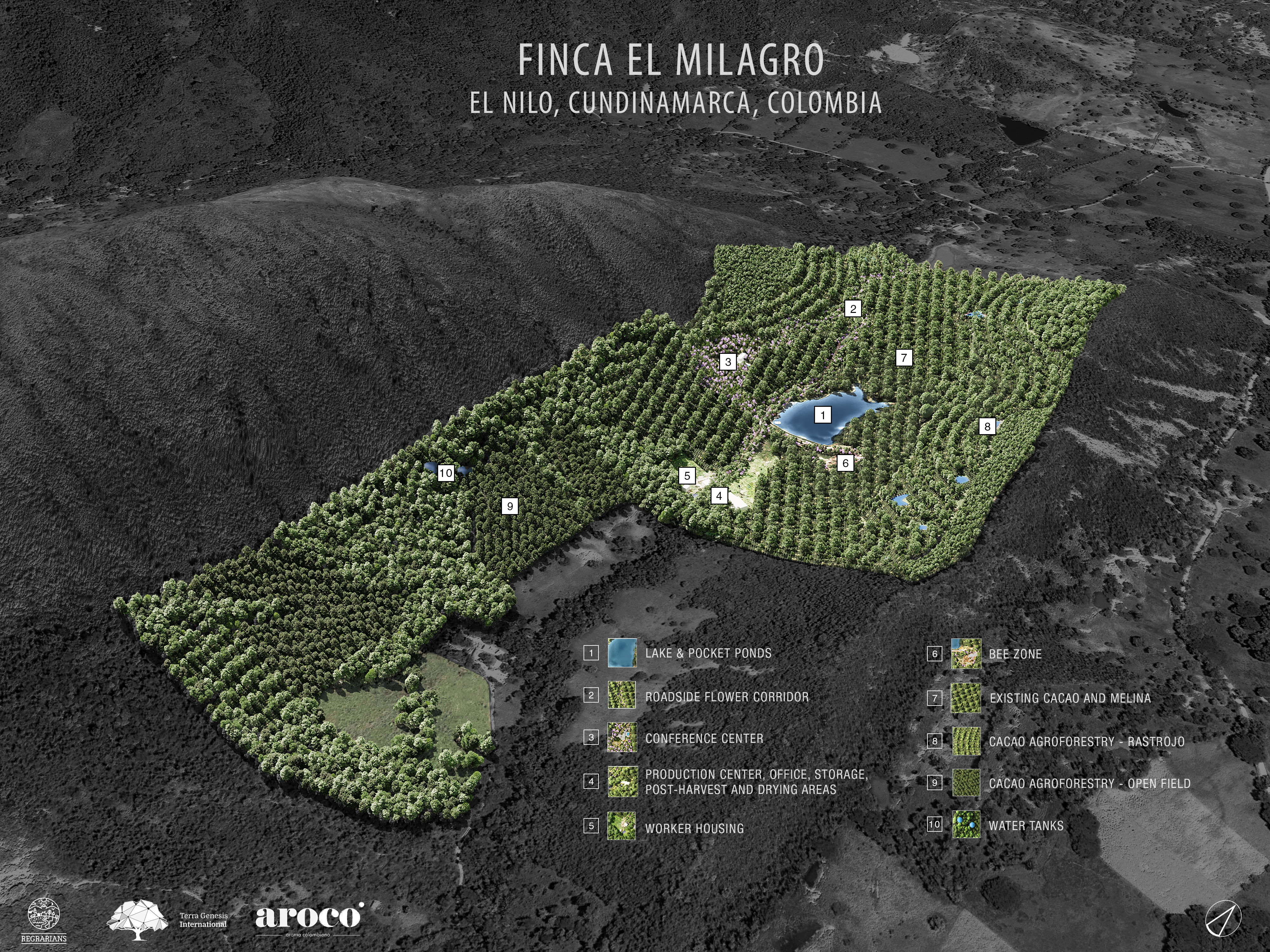
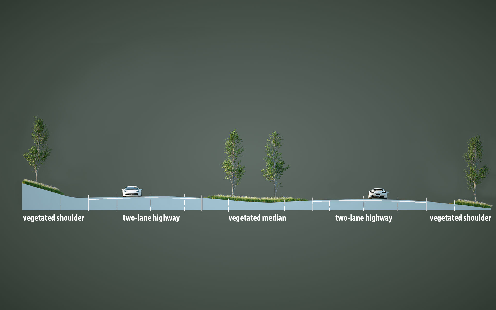
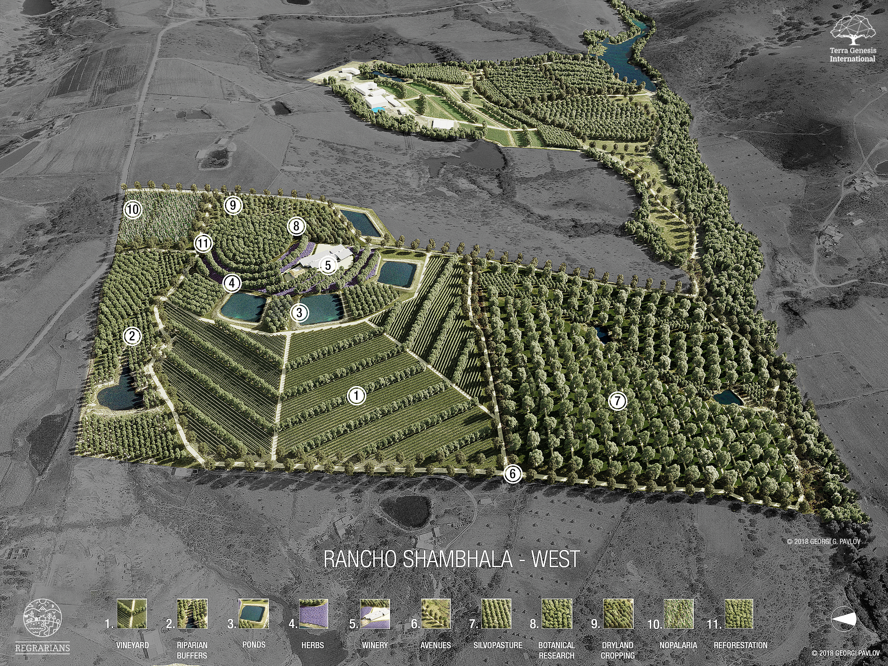
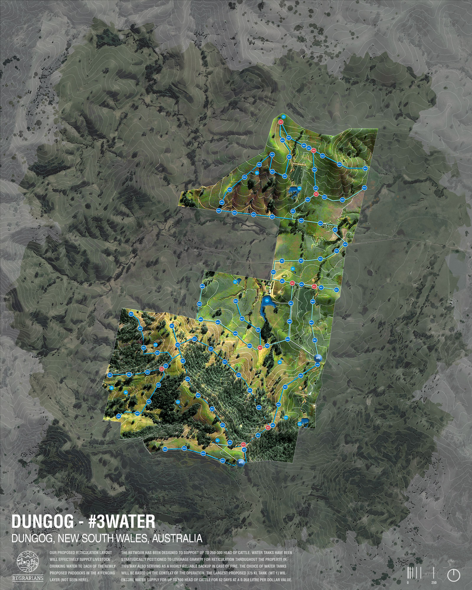
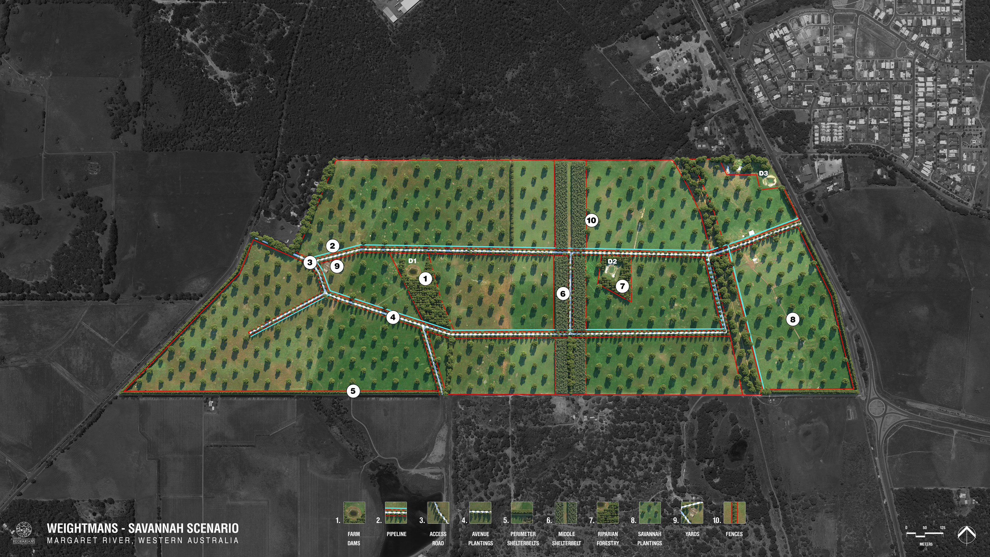
- 2D – plan views looking from above
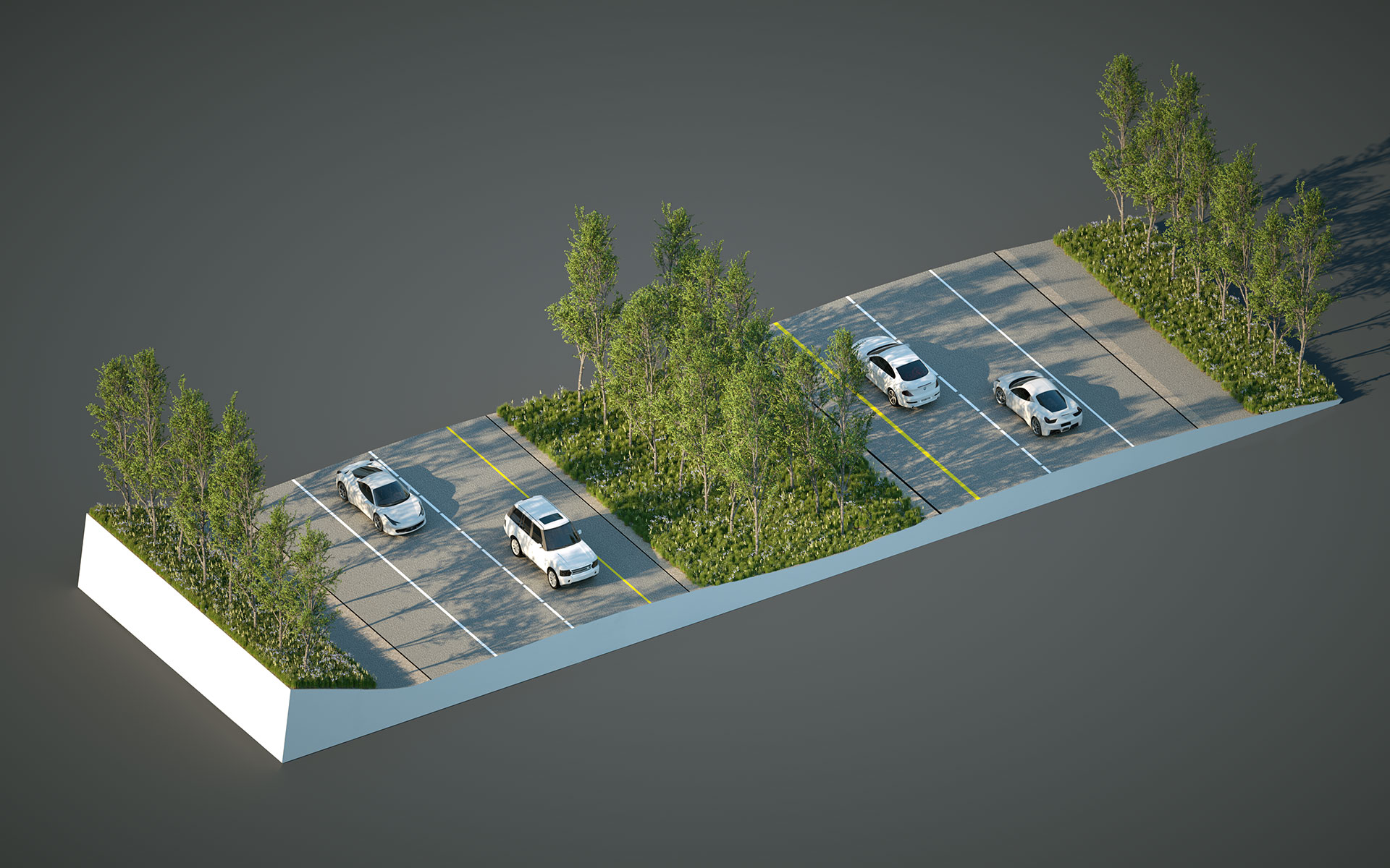
- Oblique – birds-eye views looking from different angles
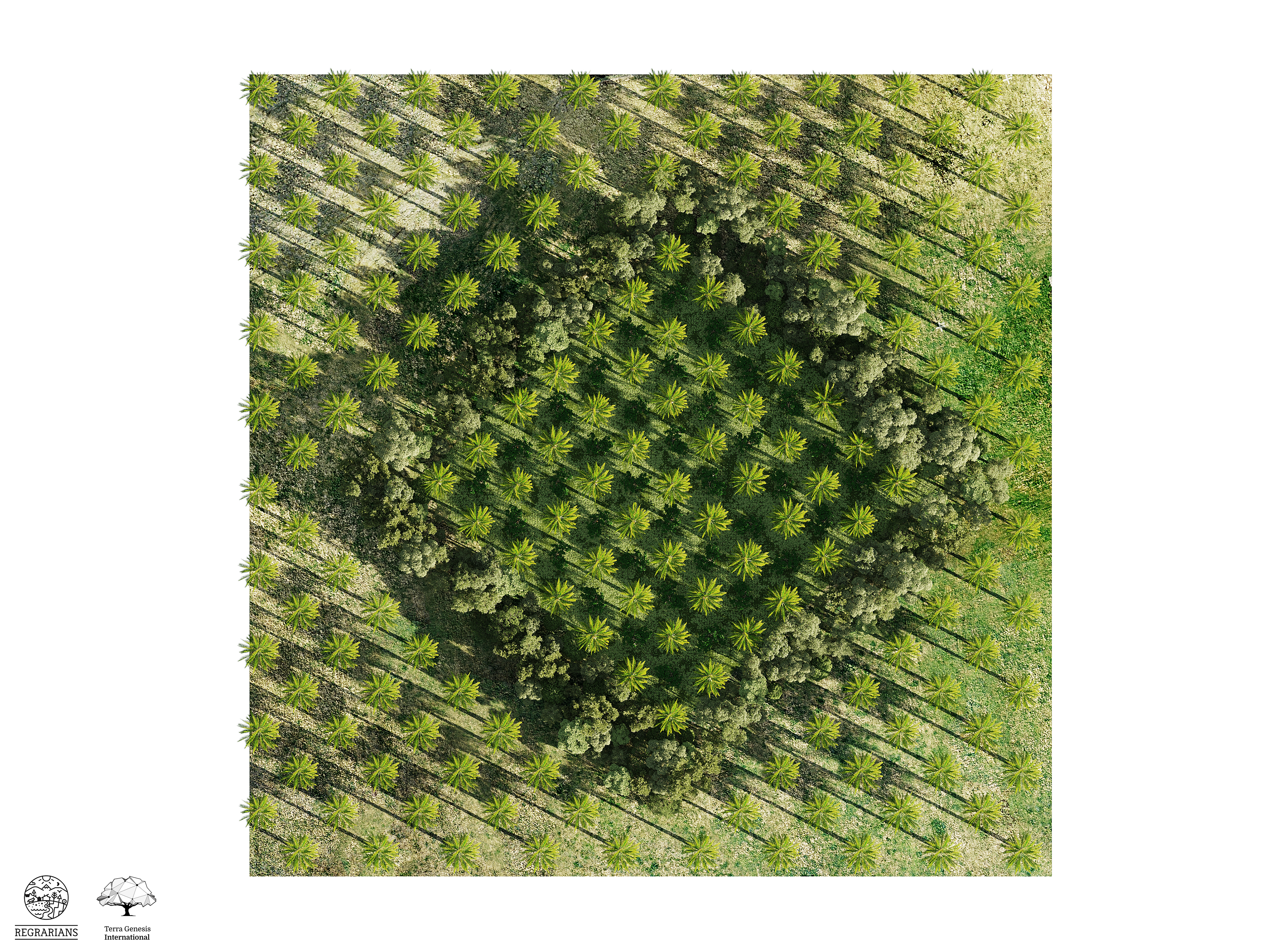
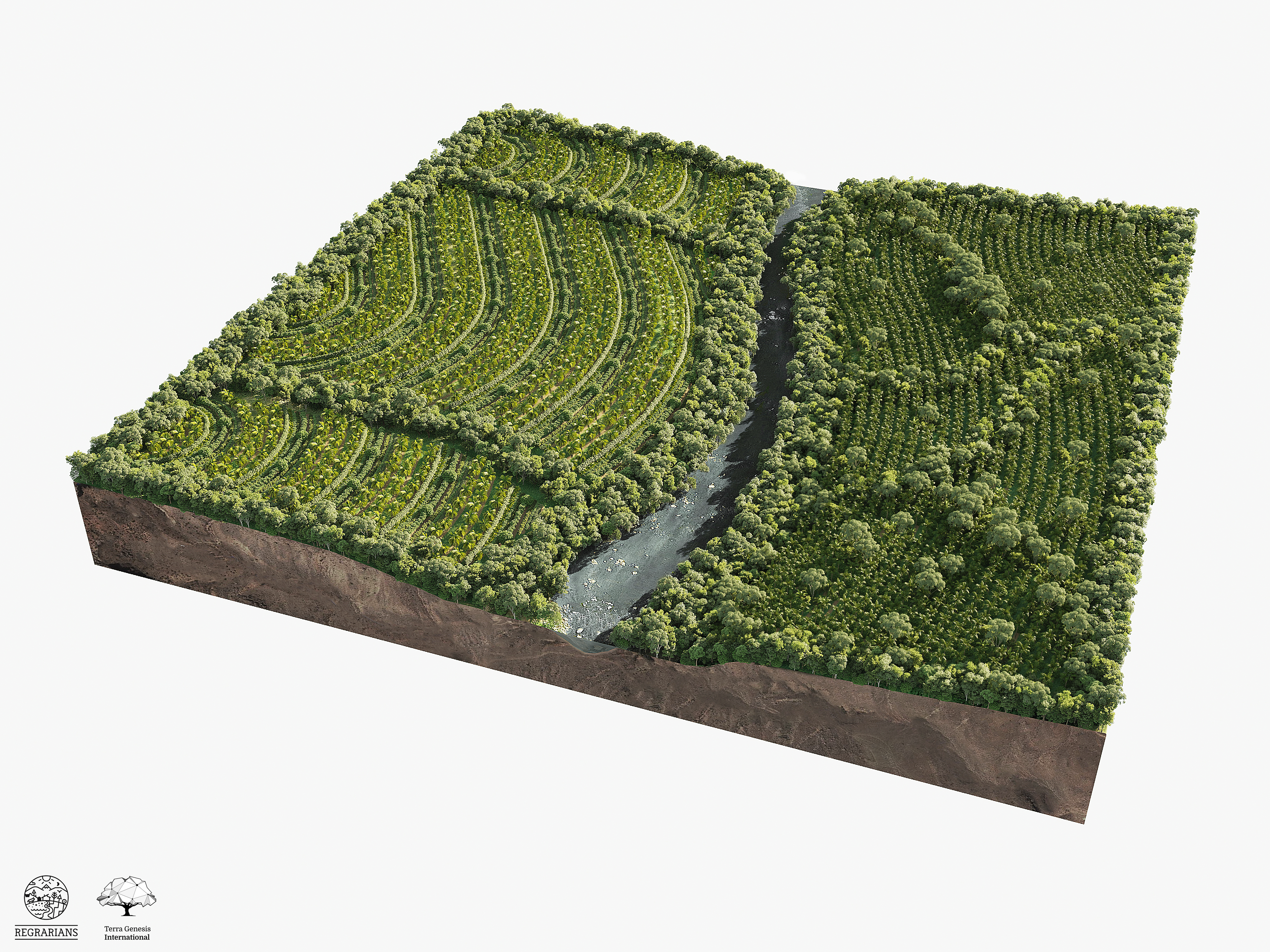
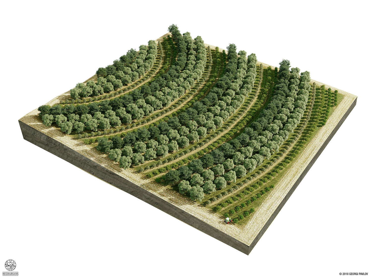
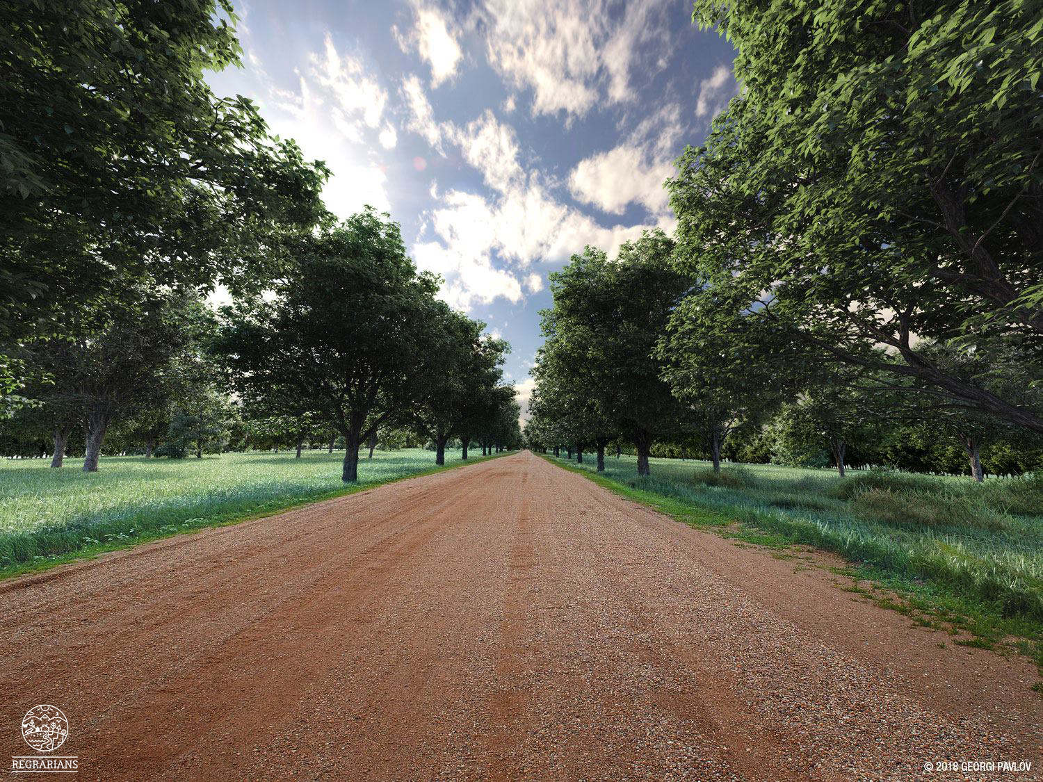
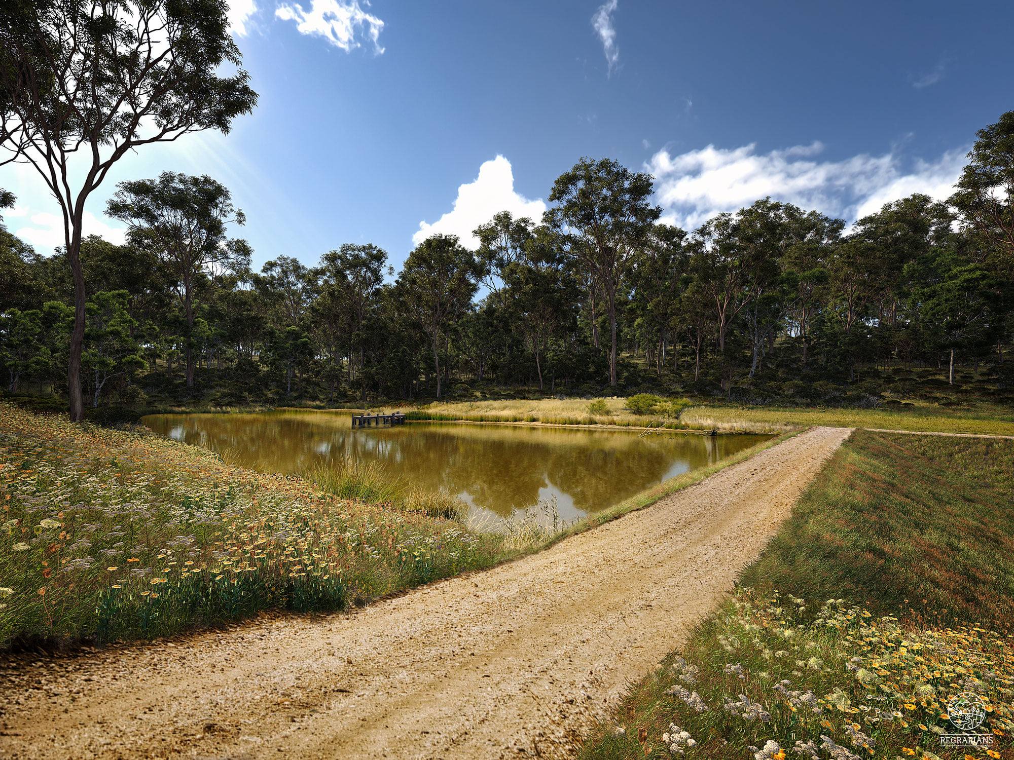
- 3D – realistic scenery of your farm’s future
Process
- YOU complete this form to provide us with a brief introduction to your project.
- WE may contact you to further clarify your desired outcomes, timeframes and the data you have at your disposal.
- YOU send all of the information / data that we request for the completion of the work.
- WE give you a cost estimate and a timeframe estimate.
- YOU pay the fee for the production of the work according to the number of pages needing to be produced.
- WE create an initial set of renders/VR/Animations.
- YOU provide feedback on the initial renders (see below, ‘How to Give Good Feedback‘).
- WE finalise the renders.
- WE send you direct you to RRenders Iterations Payments Page for the final cost of the work (see below, ‘Iterations‘).
- WE deliver to you the final renders in a Google Drive folder reserved for the project.
Iterations
Requests for iterations will be charged based on our hourly fee (USD$150/hour) with a cost ceiling at the standard per page rate for that particular RRenders products. It is therefore in your best interest to provide as accurate and detailed information and feedback as necessary during steps 1., 2., and 6. of the process in order to reduce the likelihood of needing any further iterations. Please see below ‘How to Give Good Feedback‘
How to Give Good Feedback
- Always use clear, articulate and unambiguous statements or directives — we love bullet points! Never use general statements. Recognise that we are working over the internet and it is often remarkably hard to understand what you envision. So for example, it is not helpful to say “Can we include poplar trees in there?”. Instead, it is much more helpful to say “Within this area outline include a stand of mature, hybrid poplar trees, spaced at 12 meter interval within the row and 10 meter interval between the rows, with crown width of 10 meters.”
- Always clearly specify the extents and positions of things. For example, accompany your comments with an exact visual outline of the given area when talking about area extents — such as when discussing tree planting patches.
- Always include an exact visual point, alignment or outline that clearly and precisely specifies where the element in question should be positioned when talking about the position of something, such as for example the position of a road or a structure.
- Always include as much detail about the dimensions of elements as possible — width, length, height, batter slope, etc. Consider that we have to build from scratch everything that you are talking about. If you were to build a house for example you’d likely want to have an accurate construction plan with clear dimensions. It’s exactly the same for us.
- Always include visual references, such as images from Google or your own photos when describing how something should look.
- Always speak of precise place, date and hour when discussing time, availability, setting up a meeting, etc. For example, it is not helpful to say “let’s meet tomorrow”. Instead, it is much more helpful to refer to precise times, e.g. “Can we meet on Zoom on August 25th, from 1300 to 1400 PM +2 GMT?”
Deliverables
The final imagery will be delivered in a crisp high-resolution and in format and aspect ratio of your preference, all of which will have been specified during the briefing stage.
In the case of 2D PlaS, they will be delivered both in an image format and as a georeferenced .kmz overlay for convenient viewing in Google Earth.
License of Use
- Unless otherwise agreed upon prior to the beginning of the project, Regrarians Ltd. reserve all rights over any imagery, data, documentation and files that are produced by Regrarians Ltd.
- You may use imagery, data, files and documentation that Regrarians Ltd. have produced for your own commercial purposes, advertisement campaigns, education, publications, etc. and will bear the Regrarians Ltd. name, website address, and logo
- You may not resell any of the imagery, data, files and documentation that Regrarians Ltd. have produced .
- You may not claim imagery, data, files and documentation that Regrarians Ltd. have produced as your own creation or claim authorship over them.
- Illustrations that have been produced by Regrarians Ltd. may be used in Regrarians Ltd. advertising and promotional campaigns
- Work that is subject to a non-disclosure agreement may be priced higher than usual due to the fact that we will not be able to use it in Regrarians Ltd. advertising and promotional efforts.
Branding
Unless otherwise agreed upon prior to the beginning of the project, all imagery, data, files and documentation that we have produced will bear Regrarians Ltd. name, website address, and logo — we’ll gladly add your branding to the illustrations as well.

Other Examples


![]()
![]()
![]()
![]()
![]()